The Grand Canyon North South Traverse: Part Two, Final Day
**Completed in 2003, the North-South Traverse of Grand Canyon is the first true Bucketlist hike that Brian ever did. He would recommend this hike to virtually any able-bodied hiker as a once in lifetime experience, if that hiker is well prepared for the canyon’s unique conditions.**
***Note that the editors apologize in advance for the quality of some of the images on this site which are ‘legacy’ pre-digital photographic prints rescued from what master hiker Cam Honan refers to as “shoebox purgatory.”
Canyon hiking is the complete opposite of mountain hiking. It is a truism in life that what goes up, must come down. It is certainly true the mountains: the final stage of a hike in the mountains is the long downhill.
But in canyon country, the reverse is true. What goes down must come up again. This reversal of the norm is one of many things that makes canyon hiking interesting and challenging.
The end of a long hike is not the place that most hikers would choose to have a lengthy, steep and in this case quite hot ascent, but there’s no getting around that here. In the Grand Canyon, the Big Kahuna comes at the end when the hiker must complete the hike by conquering the toughest part.
And in the Grand Canyon, the Big Kahuna can turn into the Big Killer. The relatively easy descent into the canyon is exactly what makes its corridor trail such a potential danger for the unwary. Inexperienced hikers often forget or underestimate the fact that all those downhill steps come with a price. They must be reversed, turned into hard uphill ones, or else you simply stay put in the canyon.
The motto should by now be clear…Down is optional. But up is mandatory.
As experienced hikers, Brian and his friends knew that the way out would be the hardest part and prepared accordingly. We stocked up on plenty of water, allowed ourselves plenty of time to reach the rim, and got ourselves an early start. In this case, early meant ‘pre-dawn.’
We were up at 4 am and on the trail by five. In mountaineering terms, this is known as an ‘Alpine Start.’ In the mountains, you need the early start to be beat thunderstorms (in summer) and avalanches (in winter and the shoulder seasons.) In the canyon, it helps you escape the biggest threat to your hike – the cruel desert sun.
We set off out of Bright Angel Campground crossing the camp’s mule corral (we only smelled it in the darkness) and got a mild start when we saw a pair of bright red eyes directly in our path, staring back at us at human eye level. A desert version of bigfoot perhaps? No, just mule deer. The canyon was alive with these nocturnal creatures, who have little fear of humans, being protected.
We crossed the Colorado on Silver Bridge, one of two suspension footbridges across the Colorado in the vicinity of Phantom Ranch. (The other, Black Bridge on the South Kaibab Trail, is older, supposedly more impressive and somewhat more famous, being the one the mule trains use.) These two bridges, less than half a mile apart, are the only two bridges for a hundred or more miles in either direction.
We could only vaguely see the river moving below us in the almost complete darkness.
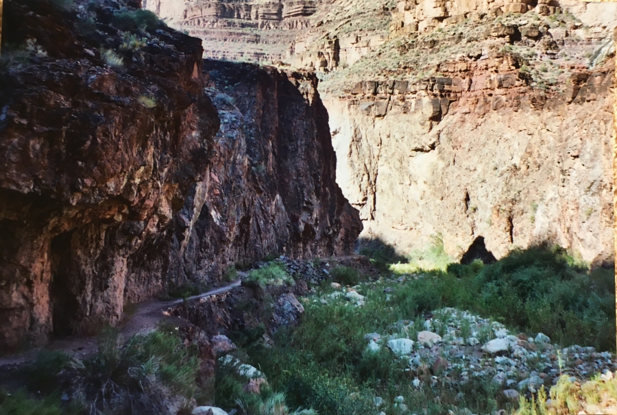
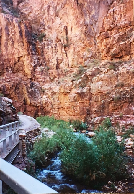
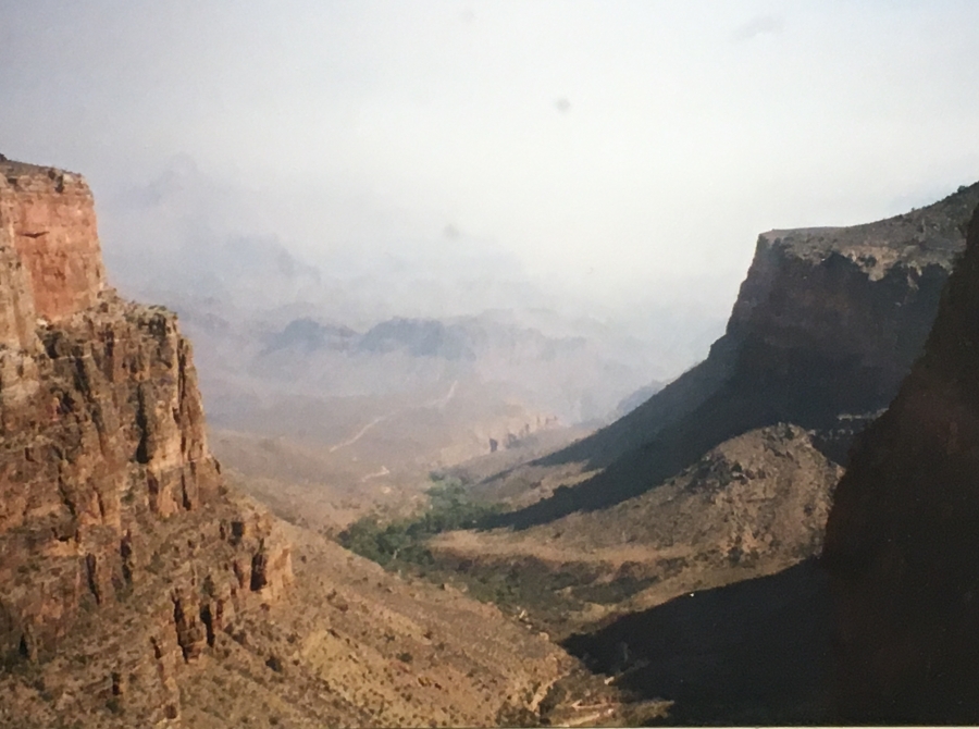
Once on the other side of Silver Bridge, the North Kaibab Trail ends, and the serious walking begins. The grades are moderate at first as the pathfirst follows a section of the River Trail along the Colorado to the River Rest House, where the Bright Angel Trail officially begins (I have almost no memory of this section as we traversed it in near complete darkness, the path lit only by our headlamps.)
The Bright Angel Trail immediately turns from the River and begins a fairly sharp ascent up a side canyon below Plateau Point, a popular destination for muleback day trips. The sun began to rise on us here, and when we crested the lip of the small inner canyon we were rewarded with the first views of the day.
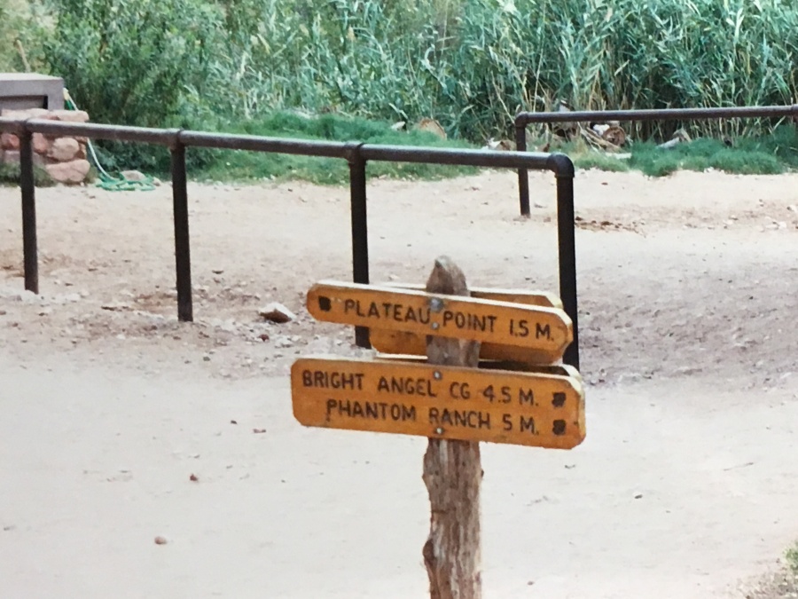
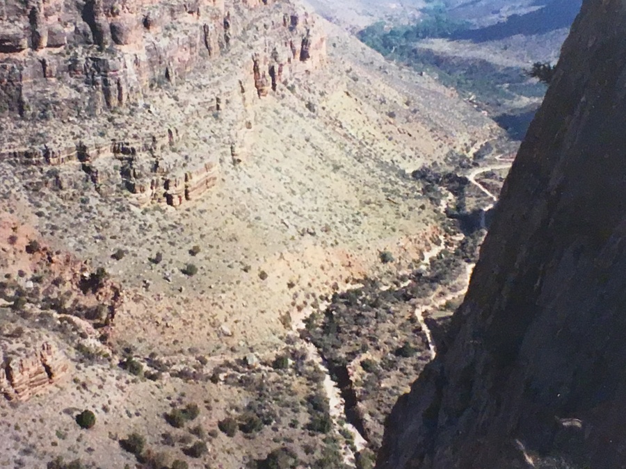
Atop the mesa that is Plateau Point the grade moderates and the trail runs mostly level for a while, and here the Tonto Trail comes it from the East. Soon it gets lost in the maze of side canyons that is the lower south rim. Without the aid of a developed trail most hikers would be completely lost here; there is no sense of space or distance, no views of the buildings on the south rim, just occasional fleeting glimpses of big rock monoliths high above that look too far away to be reachable. But in fact, these are below your actual destination.
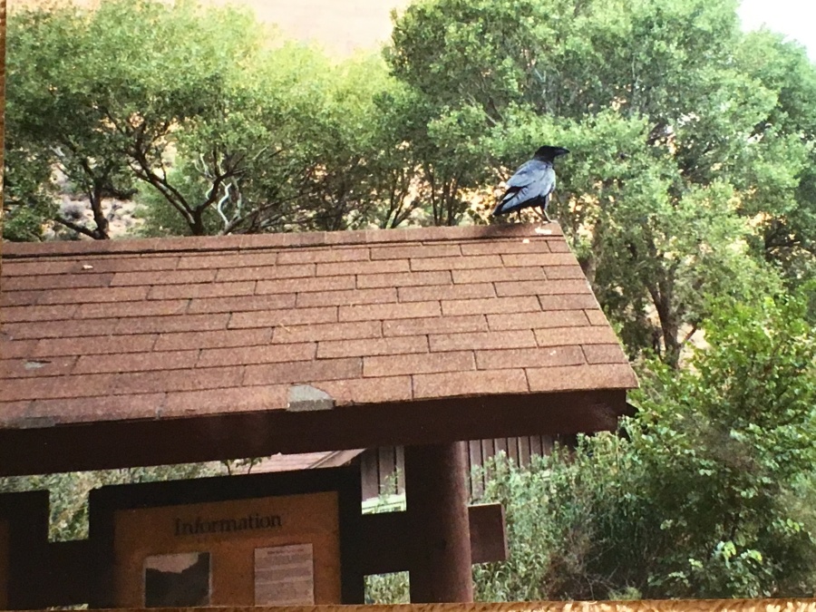
At 4.6 miles, the trail reached Indian Garden Campground, a very impressive campground nestled in a surprisingly cool microclimate where cottonwoods grow in profusion. There is water and benches here on which to relax, and winged friends to be for scraps which you may happily give up to lighten the load. Even though miles wise the days hike is almost half over, you are by no means halfway done with your efforts. In fact, MOST of the elevation still lies ahead. Indian Garden is ‘only’ 1300 feet above the Colorado. You have another 3000 feet to go before the South Rim, and five miles in which to do it on.
Indian Garden was, as its name suggests, used by the native American Tribes who inhabited the canyon for millennia before the coming of European settlers. In fact, the route of the Bright Angel Trail follows a major route used by the early inhabitants. When you walk this trail, you are truly walking in the footsteps of history.
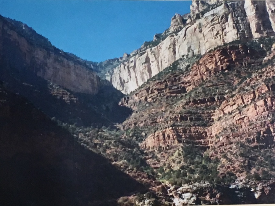
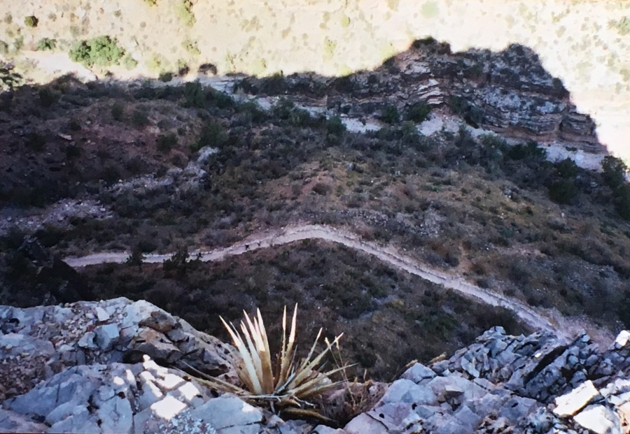
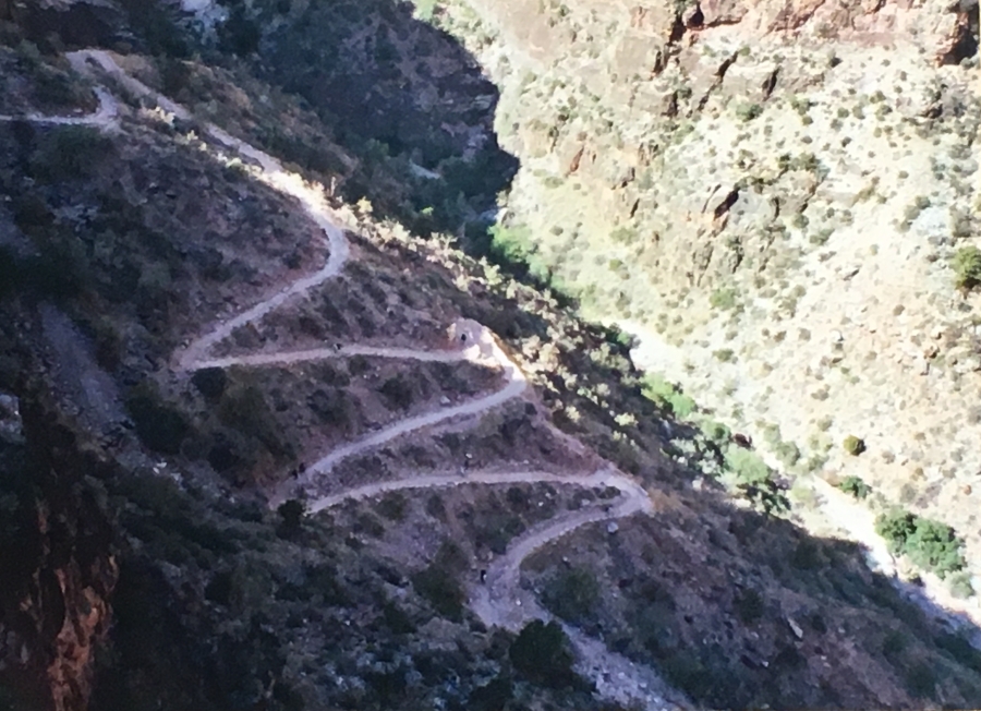
After Indian Garden the trail heads deep into the long, narrow canyon of the Bright Angel fault and begins tackling the first of many headwalls in earnest. Then fun such as it was it over…the next four miles are serious climbing. Now come the switchbacks, and they won’t let up till you run out of trail. Though none of these areas is as lush as Indian Gardens there are some fascinating microclimates en route, and much opportunity to see wildlife. We saw some more deer. It is also about here that the real views began to appear, helped by the steadily climbing sun.
And it was also about here that mid-morning fell upon us, with its resident heat.
Up and up to the Three Mile Rest House, whose name suggests hope and a certain inevitability but also no small amount of dismay. Three more miles. Of this.
The switchbacks get really severe after this, but one does start to get some views of the actual South Rim, and sometimes a glimpse of a building or two upon it. The end is in sight.
At the mile and a half resthouse one is a tantalizing thousand feet below the rim, so close you can almost reach out and…okay so it’s still a long damned away. But you can look back and see the amazing way that you’ve come…the endless zigzag that is the switchbacking Bright Angel trail, like a seam sewn into the landscape. You have already accomplished a palpable amount, however much may yet lie ahead.
It’s almost here at the Mile and a Half Rest House that most top off their water, because from here on up, there’s nary a drop till the top.
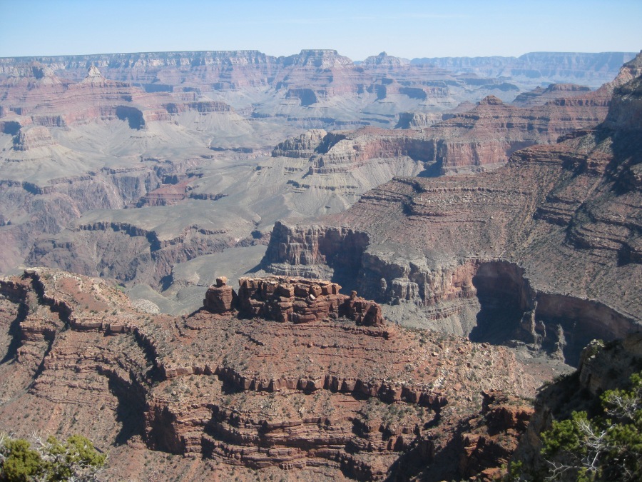
Up and through some of the steepest, but most scenic sections. Now the crowds begin to appear…well rested cheerful hikers on their way down to the Rest House for a jaunt. But the views open out to those magnificent ones only to be had from the Grand Canyon’s South Rim, and no place else on Earth. And they only get better. The Grandest Holes on Earth appears before you in dramatic, morning-gloried splendor.
At three quarters of a mile the worst of the switchbacks end, and the first (in this direction) of two tunnels in the sandstone appear. At a half mile you round the last major switchback, and cross another tunnel…the buildings of the noisy South Rim are right above you now, and it really does appear you can touch it.
Then, up the last section…a flight of steps appears and…you are walking on concrete, through buildings below the rim. And then, suddenly, you are there. Before you are throngs of people carrying ice cream cones and cups of sodas, snapping pictures of the panorama. A few stop to stare at you, but most don’t even notice. Val Murphy had already beaten me up to the Rim, but John, carrying his apartment building sized pack, was still lumbering after. And would be for some time yet.
“Did you come across the canyon?” Woman carrying a Nikon Camera asked.
“Yes,” Brian could only croak, and point. There across the canyon, plainly visible, is the greenish roof of the North Rim’s Grand Canyon Lodge. Where it didn’t exactly begin but…close enough. We had, in fact, earned the bragging rights. We had done the crossing.
Brian had done what at one point he was not sure he could do. He had completed the longest, toughest hike of his life. He had crossed the Grandest Hole on Earth, North to South, entirely under his own power.
Now, all he wanted to do was sit, and maybe have a coke.
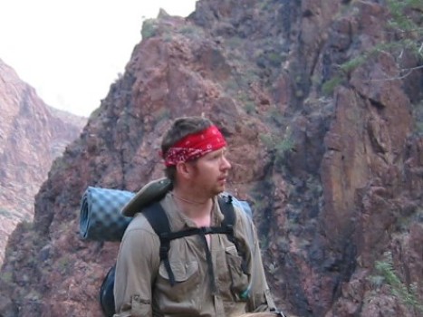
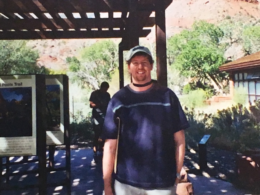
Brian in a photo taken on the second or third day of the traverse.
An interesting postscript to this trip…
Successful as the hike was, the events that unfolded after the hike nearly turned the trip into an adventure of a different sort, and not the fun kind.
As stated previously the Grand Canyon North South Traverse is a 23 mile long hike that requires a 220 mile drive to get back to where you started. Unless you can manage the hike with a car in your pack, you are going to need to scrounge up a ride somehow.
We had booked spots in a shared ride van to transport us, and our packs, back to the North Rim. After an overnight stay on the South Rim at one of the many outbuildings at the GC’s Maswik ‘Lodge’ (translation: Overpriced two and a half star motel) we met up with our van driver out front of the main bus terminal area in Grand Canyon Village.
(For those who have not been to the Canyon, or not been recently, rest assured Grand Canyon Village is one of the most crowded places imaginable, with cars, buses, pedestrians, construction equipment, locomotives, mules and even the occasional elk clamoring for attention.)
Our van driver was an interesting character to say this least. He pronounced himself an avid hiker and had claimed to have climbed Mt. Humphreys, the highest point in Arizona, as well as Mt. Whitney, the highest point in (fill in the blank.) He also laid claim to no fewer than 17 mountain lion encounters – I had not before nor have since met a person who claimed to have seen more than two.
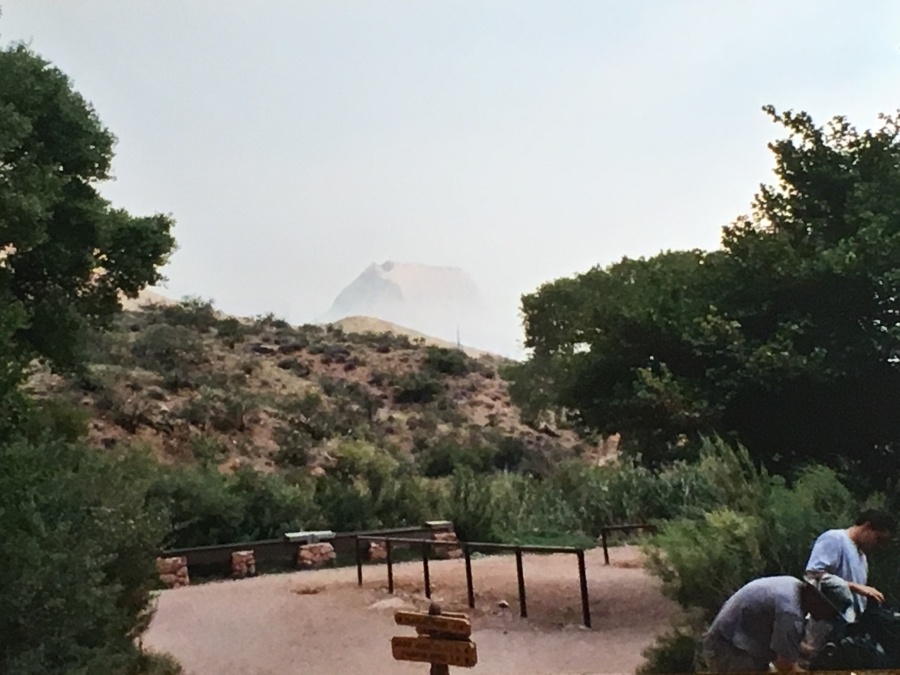
At any rate, we had been eyeing with some concern a fire that could visibly be seen burning miles away on the North Rim. In fact, you could not possibly fail to see it.
Our van driver confirmed that our fears were warranted. There fire, he said, was not under control and was presently headed in the direction of the developed area of the North Rim.
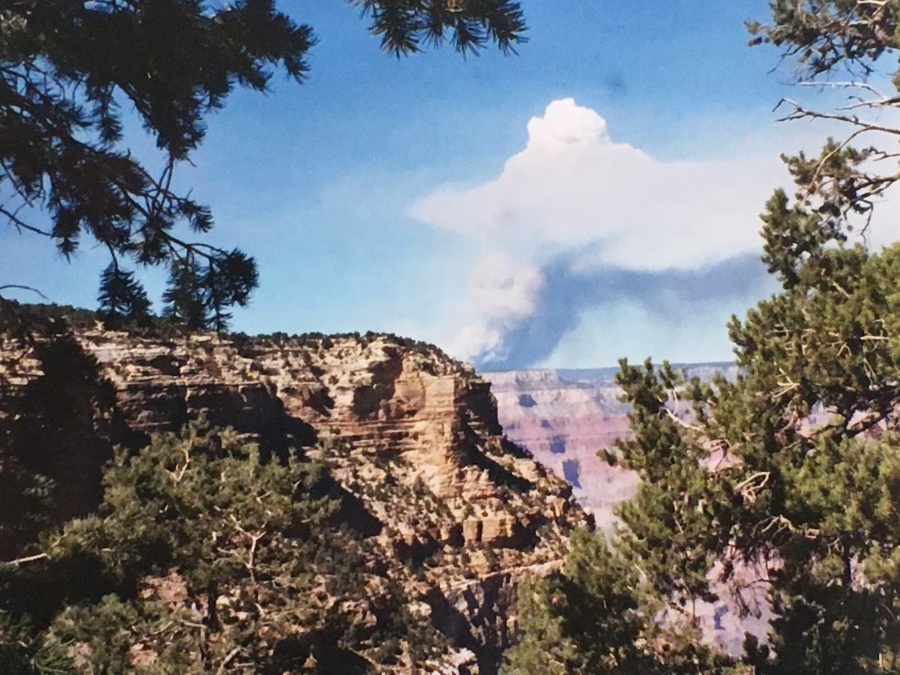
Fire burning conspicuously on the north rim as photographed from the South Rim near the end of the traverse.
Long story short, by the time we got to Jacob Lake, 44 Miles from the North Rim, it was nearly sunset. Here, we found a police road block across Highway 67, the lone entrance road to the canyon. The driver conferred with local authorities and soon returned to confirm what was by now quite obvious…the North Rim of the Grand Canyon was closed, and people were being evacuated; no one by emergency personnel was being allowed in. Indeed, it seemed like the developed area of the North Rim, including the impressive Grand Canyon Lodge, were seriously threatened by an approaching inferno.
There was good and bad news. The good news was that our group had actually booked cabin for the night right where we were at Jacob Lake Inn. Our plan had been to retrieve the rental car from the North Kaibab Trail parking area and return here, as it was just a short distance up the road (and cheaper than lodgings in the canyon, where on the North side are few.) So, our accommodations were in no way impacted by the change of plans.
What WAS impacted was our transportation. Without a car, we were not making it back to Vegas. It was a very long hitch hike.
A tense and anxious time followed as the hours passed, the sun slowly set, and the road did not reopen. It began to look like there would be no chance of getting our rental car until at least the next morning…a serious blow to our plans (we were due to fly out early the next afternoon.) And would anything be left of the car but a heap of burned over slag? It looked like we could be marooned there, along with many other hapless travelers, for a long time.
Finally, the driver came rushing up…a window of opportunity had opened just a crack. Park authorities were allowing people with vehicles to come and retrieve them, but we had to move quick while there was still time. John and Brian rapidly volunteered to go and hopped aboard the van which pulled past the road block and into the National park.
What followed was one of the strangest drives of Brian’s life, down an unnaturally dark and traffic free road, air so choked with smoke that visibility with almost nil. Deer stood about on the roadside in groups nibbling on grass, seemingly oblivious to the looming peril of the fire, or maybe just confident in the abilities of their human custodians to handle the blaze. When we finally passed the entrance to the park, we found the admission kiosk wrapped up in mylar like a bulky astronaut; a score of brushfire trucks sat pulled off by the side of the road. Clearly, the park staff were expecting the worst.
The going was slow, but finally we arrived at the parking area. There, among the few vehicles still present, was our car. John and I hopped in and – well, not exactly raced, it was to dark and smoky, the road too winding – but we inched our way back to base with all the alacrity we could spare.
The car was secure…We had managed to pull our bacon out of the fire, so to speak, and the rest of the trip proceeded without much of a hitch.
(By the way, the Poplar Fire, as it would be known, did burn over 7000 acres of forest, but the developed areas of the North Rim were left untouched.

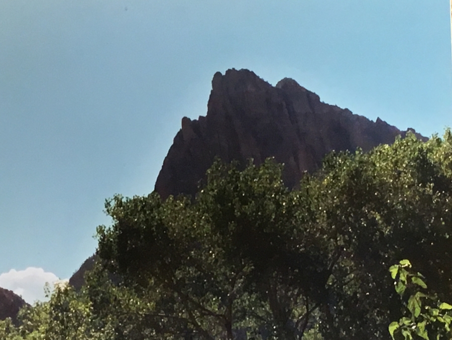
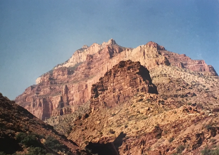
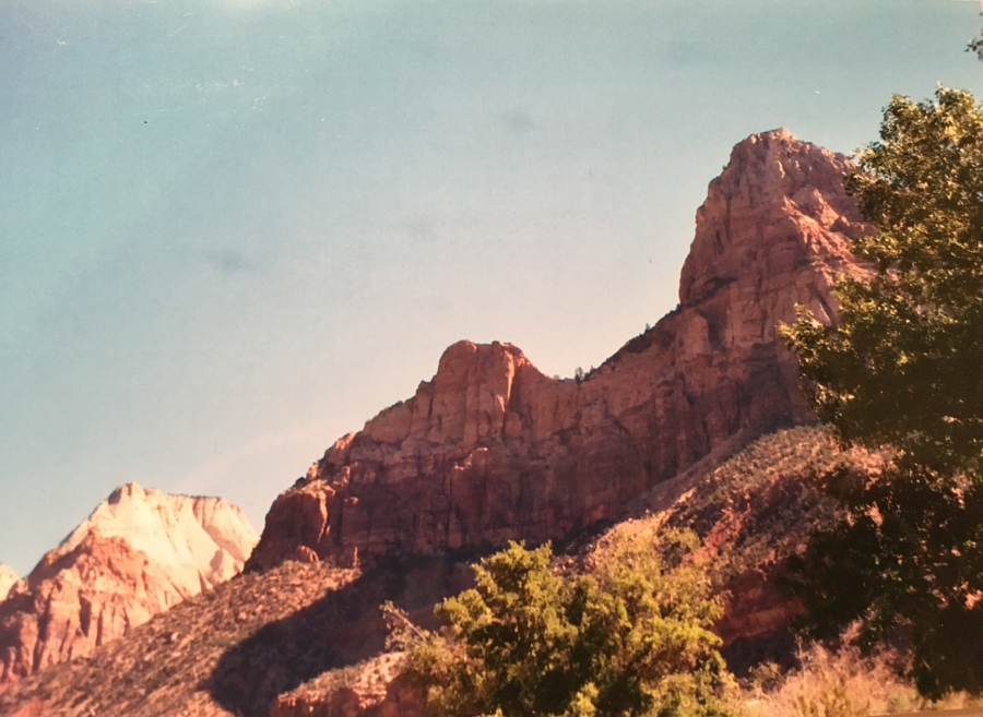
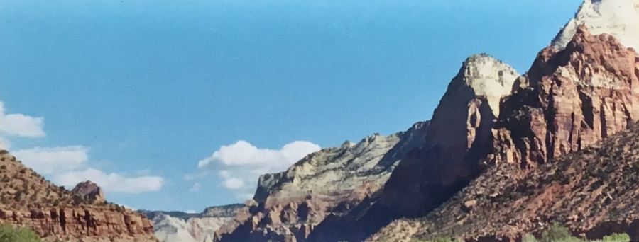
Oh…and we did cross through Zion National Park on the return leg where these pictures were taken. A great way to cap a great adventure!
Down in optional…Up is mandatory. But home is always welcome.
Next Up: Can I Hike the Grand Canyon North South Traverse?