The Grand Canyon North South Traverse: Part One, Days One and Two
**Completed in 2003, the North-South Traverse of Grand Canyon is the first true Bucketlist hike that Brian ever did. He would recommend this hike to virtually any able-bodied hiker as a once in lifetime experience, if that hiker is well prepared for the canyon’s unique conditions.**
***Note that the editors apologize in advance for the quality of some of the images on this site which are ‘legacy’ pre-digital photographic prints rescued from what master hiker Cam Honan refers to as “shoebox purgatory.”
The National Park Service calls the North Kaibab Trail “the least visited but most difficult of the three maintained trails at Grand Canyon National Park.” Notice the qualification…there are scores of trails in the canyon but the majority are not ‘officially maintained.’
Those that are maintained — the North Kaibab, South Kaibab and Bright Angel Trails — are referred to as the ‘corridor trails.’ If you stray from them, you best know what you are doing.
Access to the Corridor’s north terminus — the North Kaibab Trail head — is via a rather non-descript parking area off Highway 67 about a mile and a half from the Grand Canyon Lodge…the trail leaves from the roadside and vanishes in unremarkable fashion into a cluster of pine, from which only the barest glimpse of canyon (and that a side canyon of the main one) is visible. From here, one would never know that one is about to enter the Grandest Hole on Earth.
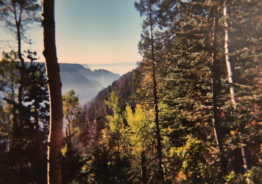
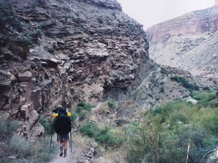
It will however quickly become apparent that you are embarking on something many degrees above the ordinary. The trail bursts into the open, with great views, and quickly begins a vigorous descent via switchbacks whose grade does not let up for many miles yet.
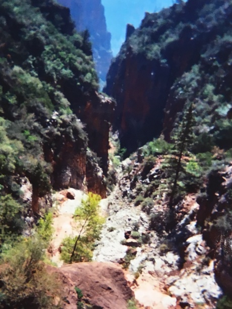
Though the scenery is impressive, the long, grand views of the South Rim are for the most part not to be had from the more heavily forested North. As the trail descends and the forest pulls back, the canyon itself starts to get in the way. You are entering the inner regions that only a lucky few will ever see.
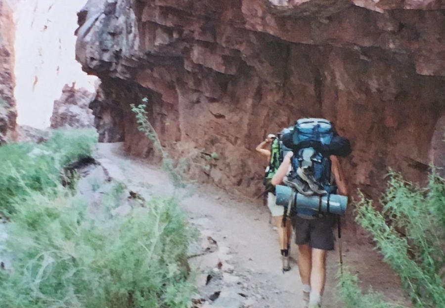
The trail, built in the 1920’s using dynamite in places to level the grade, is steep but never extremely so, and the footway is well graded. It crosses through a man-made tunnel in the limestone (The Supai Tunnel — the National Park Service would never do such a thing these days if it could be avoided.) The trail then proceeds through a section of Redwall Limestone where the trail is ingeniously carved right into the rock…this is one of the most spectacular sections on the whole hike.
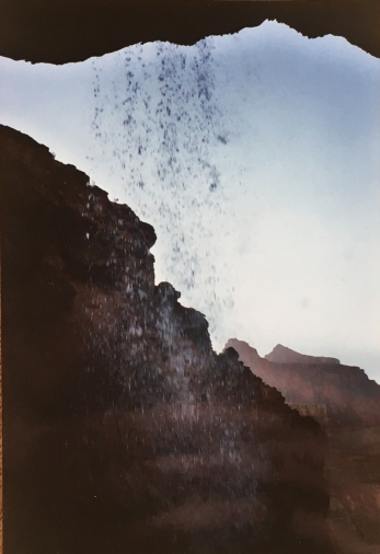
Soon after it passes Roaring Springs, where water emerges from the very cliffs in a surprising fan-tailed series of waterfalls whose roar echoes through the canyon. Roaring Springs is in fact the source of the water for the developed areas on the South Rim, where it is carried by means of a gigantic pipe visible at intervals throughout the hike.
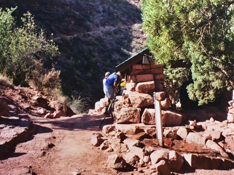
Soon after the spring the trail crosses a bridge with an impressive view of Bright Angel Canyon, then arrives at the Pumphouse Residence, a converted residence turned into a Ranger Station, and the Manzanita Rest area. The main attraction here is water, obtained from a hand operated pump in the ground. Hikers queue up for it after resting here for a bit, and then continue down into the canyon.
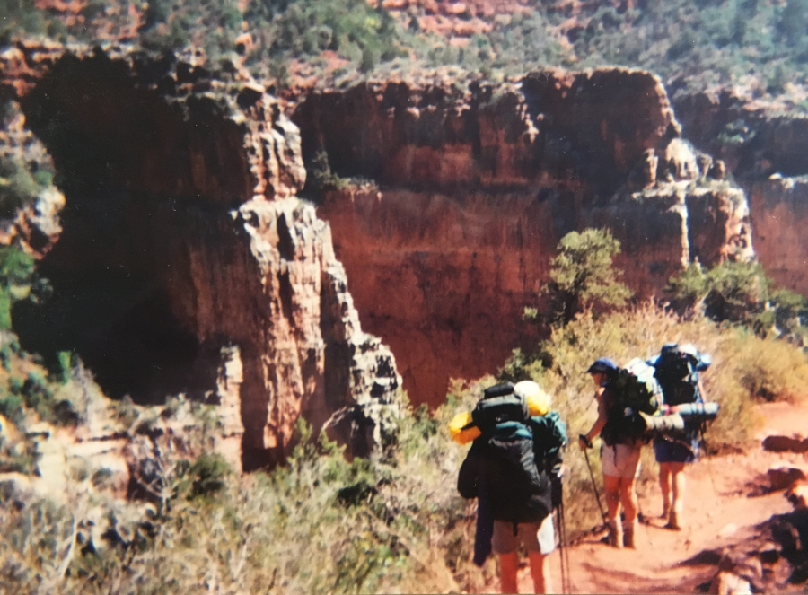
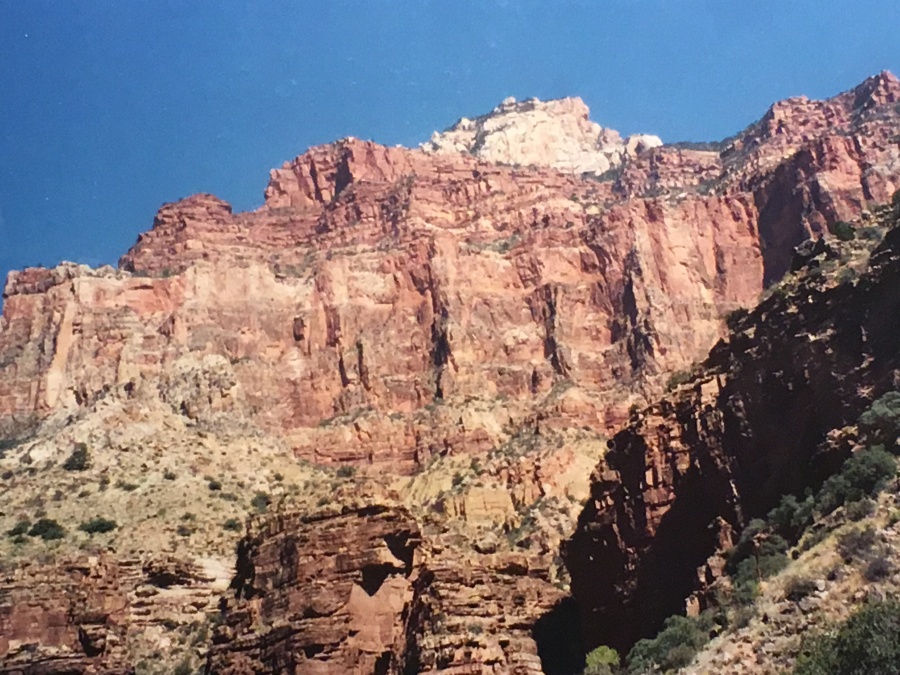
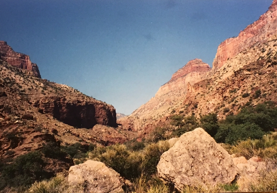
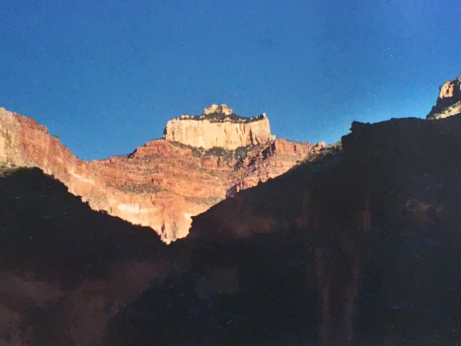
Here the trail enters the canyon’s Inner Gorge…the parts that can’t be seen from high above except for fleeting glimpses. The views here are the opposite of those on the rim…instead of looking out upon a fantastic landscape, one is looking up out of the landscape at the rim high above.
But at times it’s hard to tell you are in a fantastic canyon landscape; sometimes it looks like you are simply walking in a shallow ravine surrounded on all sides by cliffs, mesas and peaks of all sorts. The visually complex geometry of the canyon folds in on itself and makes the hiker feel tiny and unimportant.
Most stop for the first night at Cottonwood Campsite, just under seven miles from the rim, for a well earned rest. It is possible to continue on another seven miles to Bright Angel Campground – the worst of the downhill is over, and the next section mostly level – but the descent itself is enough in one day for most people.
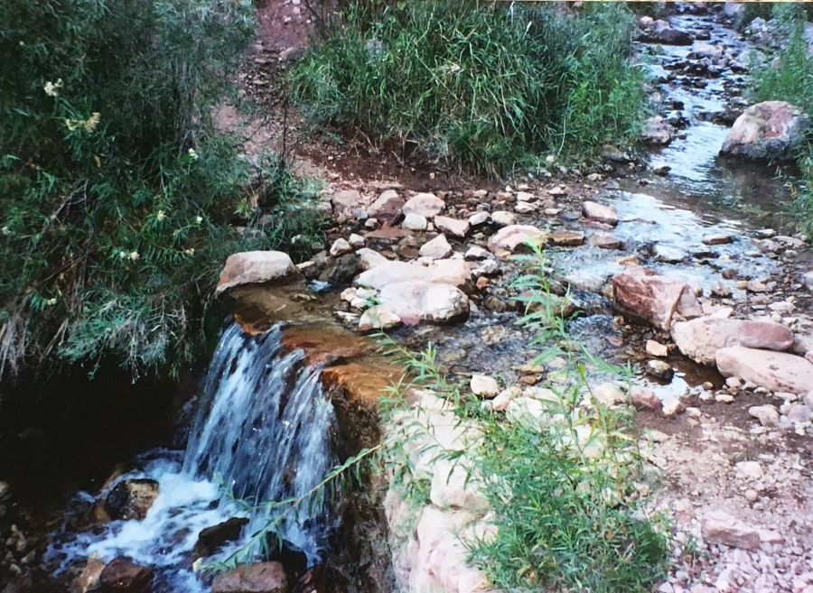
Cottonwood is, at any rate, a fantastic campsite. Not only does the hiker have the opportunity to cool off with a dip in the clear swift running creek, but when darkness falls, the night sky is staggering, full of stars that shine so brightly you can clearly make out the looming canyon walls contrasted against them (plus a few lonely lights far away on the rim, which might as well be stars themselves.) This is a good spot to take a very well-earned rest.
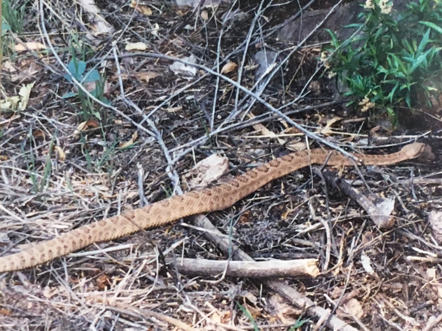
It was here that we saw the only rattlesnake of the trip…a canyon or ‘pink’ rattler as they are known. It wasn’t bothering anyone and seemed content to slither along as we took this picture.
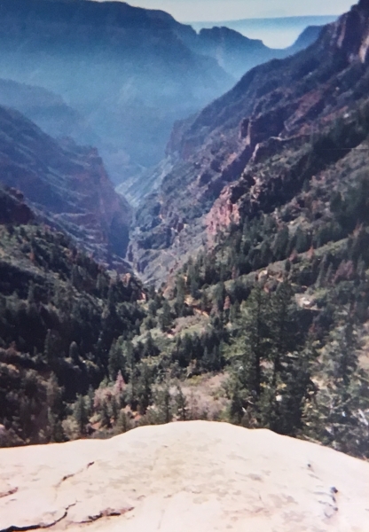
Setting off the next morning we headed into the glorious site of the new risen sun brightly reflected from the canyon walls ahead. The South Rim was beckoning us.
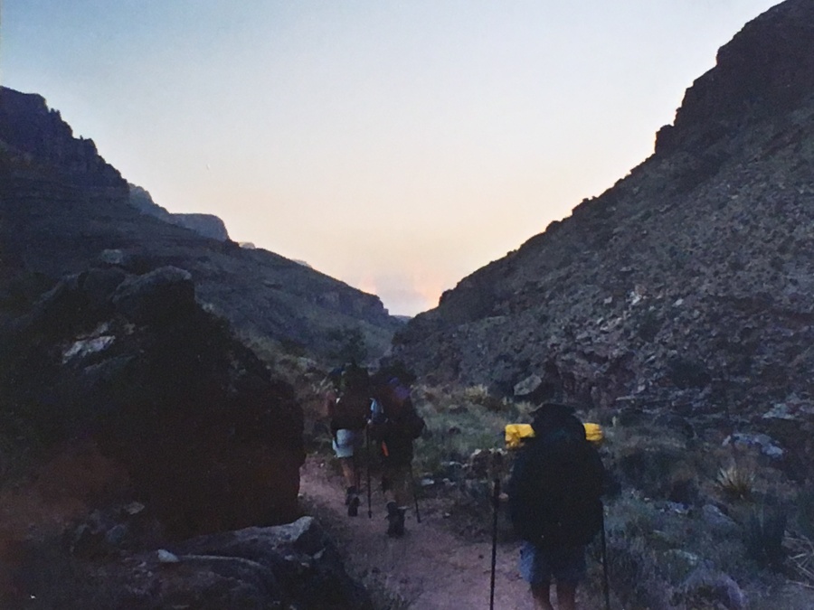
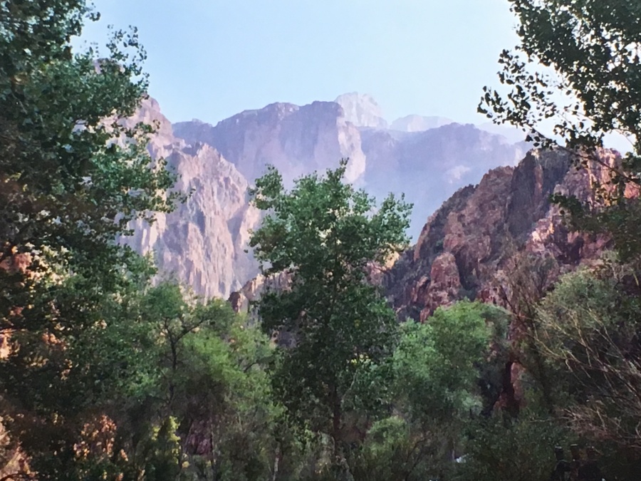
We were aware that there were three wildfires burning on the North Rim, which is no unusual thing at all. When Chris and I visited in 2001, there had also been fires in progress. But these fires were closer and the air fuller with smoke; the haze hindered the long range views a bit but made the sunsets and sunrises more spectacular.
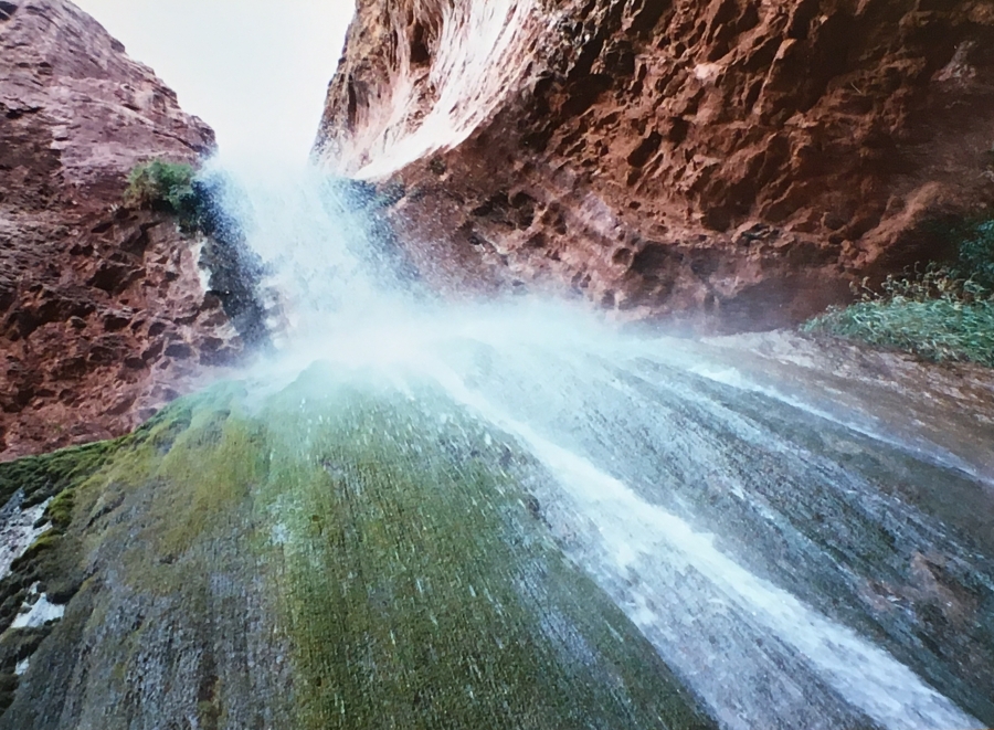
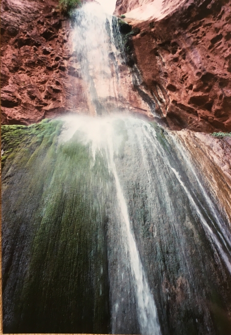
A mile and half out of Cottonwood campground is a short detour trail to the amazing grotto of Ribbon Falls, which is well worth seeing. It’s amazing how many clear running waterfalls and lush microclimates there are on the canyon bottom and in the side canyons.
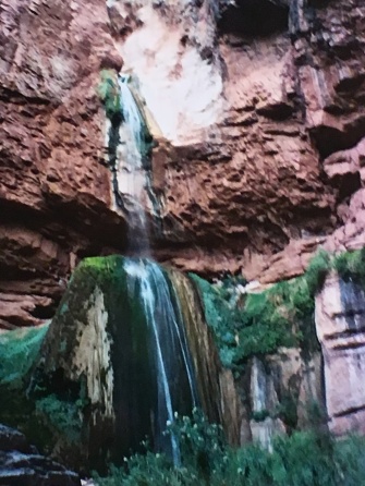
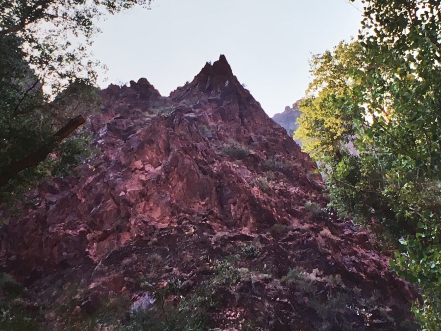
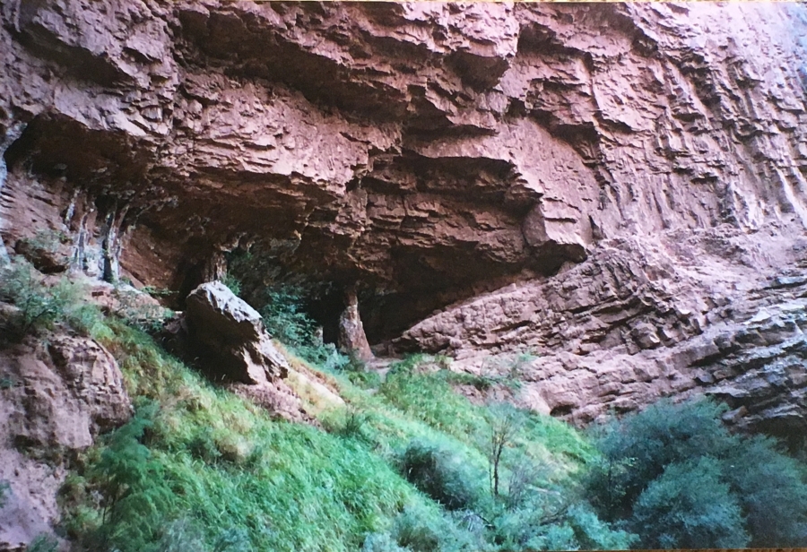
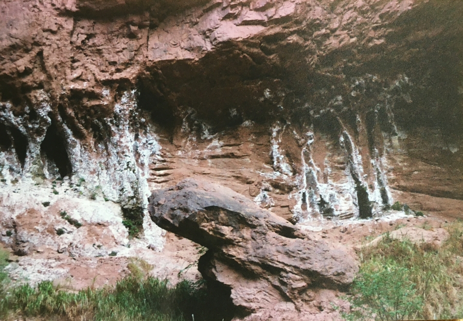
There are also some odd rock formations around the falls.
Past the falls it is mostly a level rolling walk into the main channel of the canyon, hard up against the Colorado. At 13.6 miles we passed historic Phantom Ranch Lodge…one of the reasons Brian had done this hike was that he had glimpsed a corner of Phantom Ranch, built in 1922, from the rim in 2001 (it can only be seen from a few places, so well hidden is the bottom.) He found himself wondering…what would it be like to go there? He was about to find out.
Actually, it’s not a whole lot…a small canteen, some stonework cabins and a barn for mules. The location – amidst towering cottonwoods on the bottom of the grandest canyon on earth – is everything. Anything ostentatious would only detract from the setting – it was designed by the legendary architect Mary Colter to be low key and belnd with its surroundings, as should be.
Our destination was Bright Angel Campground, about a quarter mile past the Lodge. It’s not as scenic as Cottonwood but it serves very nicely, with many private, widely spaced and well protected sites. Only thing we lacked was enough flat space to lay out all our gear.
By now the physical injuries were adding up. Val Murphy had taken a fall and injured (actually broken) a finger, which had swollen up on her; to make matters worse her wedding band was on this finger and now couldn’t be removed. My own feet had been lacerated by, of all things, the lightweight Teva sandals I had brought as camp shoes (I had walked with them in the water, an ill-advised move…the straps and especially toe thong had cut an ugly red channel in my skin. Because of this I never again wear thong-type sandals.) John was struggling under the weight of his backpack which, as usual, was too big.
We would sleep here in the canyon for one last night and heal what wounds we could. Tomorrow we would get a very early (4 am) alpine start to beat the heat for a hike up out of the canyon. As the Grand Canyon’s SAR service has as their motto…Down is Optional…Up is Mandatory!

Next Up: The Bright Angel Trail: Up is Mandatory