Three Ridges Loop Hike Via the AT
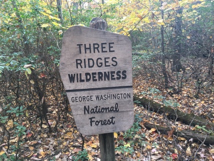
- Location: George Washington NF, VA
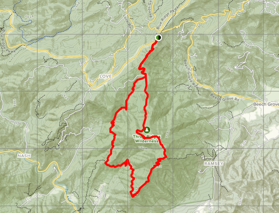
- Distance: 12 to 14 miles depending on point of entry
- Elevation Gain: About 4000 ft by the route described here
- Time: Two days
- Difficulty: Strenuous
- Best season: Early Spring or Fall
- B.I.T. Rating ****
**Outside Magazine named the Three Ridges Hike as their best hike in the state of Virginia. While we feel that Old Rag is superior, this is certainly a worthy candidate for the honor.**
Directions: Most commonly done from the North, entering the loop at Reid’s Gap on the Blue Ridge Parkway where it is crossed by VA 664. Trailhead is sixteen miles south of Rockfish Gap and US 64; look for the cars parked on the left of the road. An alternate but very similar itinerary is to enter from the south, at VA 56 north of Tyro, NC.
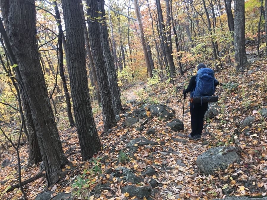
Brief Description: Though it may not be widely known, this excellent overnight backpacking trip is one of the best loops hikes possible using the Appalachian Trail as a main corridor, and one of the very best hikes in Virginia, period. It has almost everything a hiker could want along the way, starting with great views; but be warned, this is also a formidable challenge from start to finish. For less experienced hikers, we would recommend the longer but more straightforward Standing Indian Loop.
Trail Map (from AllTrails)
Why Do This Hike?
- Who doesn’t love loop hikes!
- Experience the granddaddy of all long-distance trails, the AT
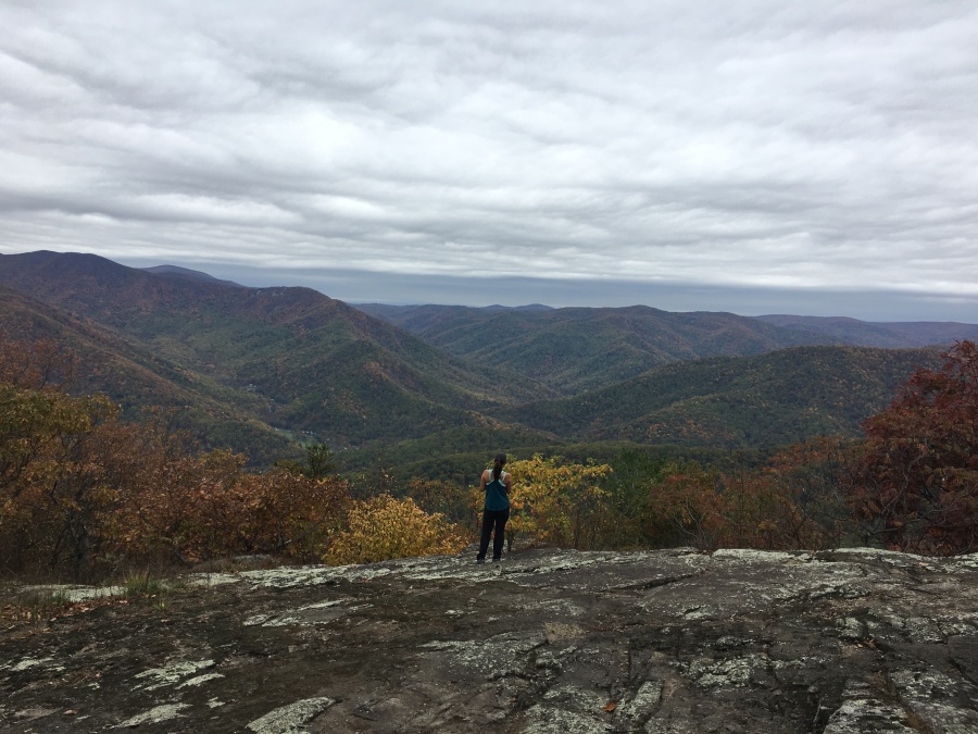
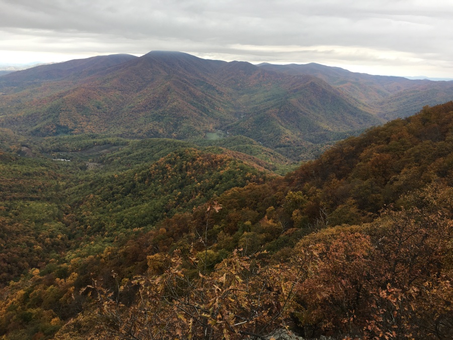
- At least two first class viewpoints right on the trail; more reachable by side trails or short bushwhacks
- Wild, rugged and challenging throughout
- Many itineraries possible
- Start at either end of the loop
- Tons of campsites (and two shelters) along the way
- Waterfalls, cascades on the beautiful Mau-Har Trail
- Mau-Har is lightly traveled
- Logistically quite easy to stage
- Close to the towns of Charlottesville, Waynesboro
- Also close to Shenandoah National Park
- Very good chance of seeing bear, other wildlife
- Could be (and routinely is) done as a single day marathon hike
- Other iconic places in this area; Humpback Rocks, Crabtree Falls, The Priest
- Finish up the hike with a drive along the Blue Ridge Parkway
- …And continue north to Skyline Drive!
But First Consider:
- The Three Ridges Hike is rough, steep and difficult
- Don’t be fooled by the 14-mile length, it will feel much longer
- Not recommended for beginners
- A lot of up and down
- Mau-Har trail, while short of being dangerous, is tough
- Steep, poorly graded and rocky
- Badly eroded, dicey section just above Campbell Creek
- The AT is better graded but also rough in places
- Traverses numerous minor slide zones with loose rocks
- Very steep scramble between second/third knoll of the ridge
- Most of the campsites on the AT ridge are dry
- Only reliable water source on AT portion is at Harpers Creek
- Maupin Field Shelter bone dry when we visited in October 2019
- Viewpoints are great, but 95% of this hike is in the trees
- On peak weekends, expect the campsites and shelters to fill
- Large groups of students, boy scouts frequent this area on weekends
- Limited trail parking
- A popular hike close to many major cities…avoid Saturday starts
- We do not recommend the single day option unless you are a very fit and experienced hiker or trail runner
Note that this loop is commonly done in the clockwise direction, saving the difficult Mau-Har Trail for the descent, and most online trail resources describe it this way. Sylvia and I did the reverse (counter-clockwise) and found this alternative to be entirely viable; basically, you trade somewhat worse downhills for somewhat harder climbs. But either way you do this, keep in mind there will be major ascents and descents on BOTH days of this hike. Be mentally prepared.