Mount St. Helens by the Monitor Ridge Route
On May 18, 1980, Mount St. Helens changed forever. That day the top quite literally below right off of the mountain.
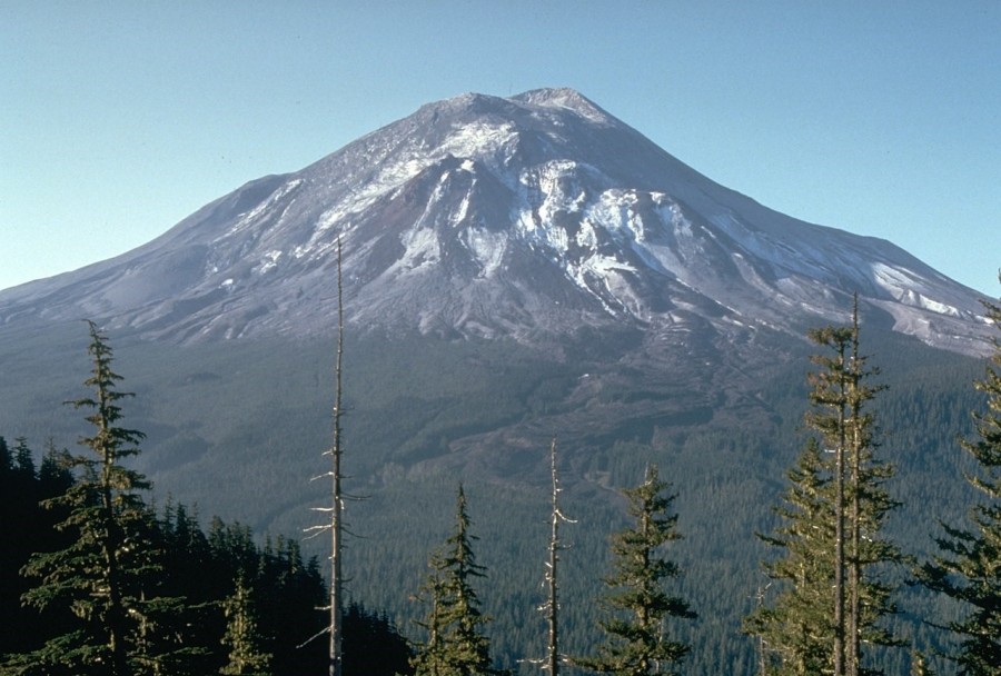
By Harry Glicken, USGS/CVO – USGS photo of Mt. Saint Helens, Public Domain, https://commons.wikimedia.org/w/index.php?curid=634392
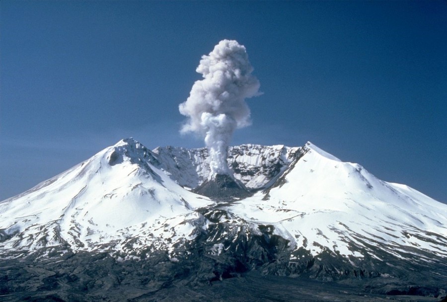
By Lyn Topinka – CVO Photo Archive Mount St. Helens, WashingtonBefore, During, and After 18 May 1980., Public Domain, https://commons.wikimedia.org/w/index.php?curid=3158771
The explosion was measured in the megatons (the same yardstick commonly used for nuclear weapons.) Combined with powerful flood waves of ash, mud and debris, the catastrophic blast resulted in the deaths of 57 people, the desolation of hundreds of square miles of surrounding terrain (untold thousands of animals were killed) and caused an estimated one billion dollars of damage. The Mount St. Helens 1980 Eruption stands as the most powerful and deadly volcanic event in United States history.
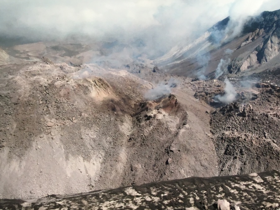
Even today, the mountain remains uneasy. The forces that caused it to come roaring back to life have not subsided. It serves as an ominous warning to those who live in the shadows of other Cascade Range volcanoes which, while not presently erupting, could do so at any time.
Would anybody dare to attempt such a venture as climbing this troubled piece of real estate?
It turns out that quite a few do. In fact, they all but line up for the privilege of doing so.
In 2008 Brian hiked to the rim of this restless mountain and peered down into its gaping crater. It remains to this day one of his most memorable days of hiking, worthy of the Bucketlist. But until recently, Brian also considered this his single hardest day of hiking.
What follows is his account of the hike of the mountain that went to Kingdome Come. Mt. St. Helens Volcano via the Monitor Ridge Route. If you want to know why Brian did this — or maybe have ideas of doing this yourself — then tune in.
Because it was there. What’s left of it, anyway.