Our Torres Del Paine Logistics Are Nearly Complete
The time for Patagonia is fast approaching.
Every resource available to us tells the same tale…book months in advance, especially for popular Torres del Paine, or else lose out. In days past it was possible to show up at this park with a tent, a pair of legs, a will, a few dollars and no particular plan at all. Considering the poor weather in this part of the Andes, that sort of ‘non-plan’ might be the best way to hike this region. A free-form agenda that allows one the flexibility to hit the best spots only on the best days, and maybe go to ground for a day or two if things get ugly.
Such days are largely gone. The immense popularity of this park (thank you, Nat Geo and Instagram!) and the very strict regulations needed to protect this fragile environment from being loved to death mandate booking every move well in advance, and then hoping for the best as far as weather is concerned.
Compounding the problem is the shear remoteness of this region…unless you own a private plane it is almost impossible to reach Puerto Natales, the jumping off point for Paine, with less than 24 straight hours of near continuous travel. And this involves (for most) at least three flights followed by one bus. After which the traveler is STILL hours from the park entrance.
Fortunately, we were fully aware of all this going into the trip and have completed most of our Paine bookings with months to spare. Two other factors in our favor: Our experience booking the Tour du Mont Blanc, which is in many ways more logistically complex than Paine; and Sylvia’s familiarity with Spanish.
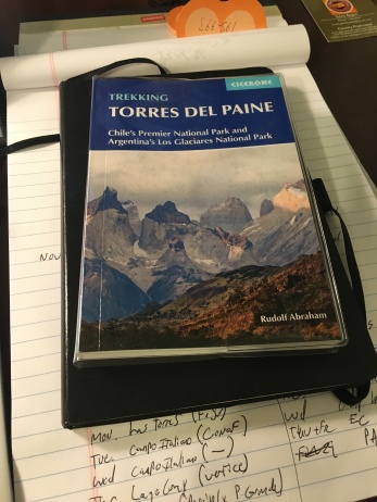
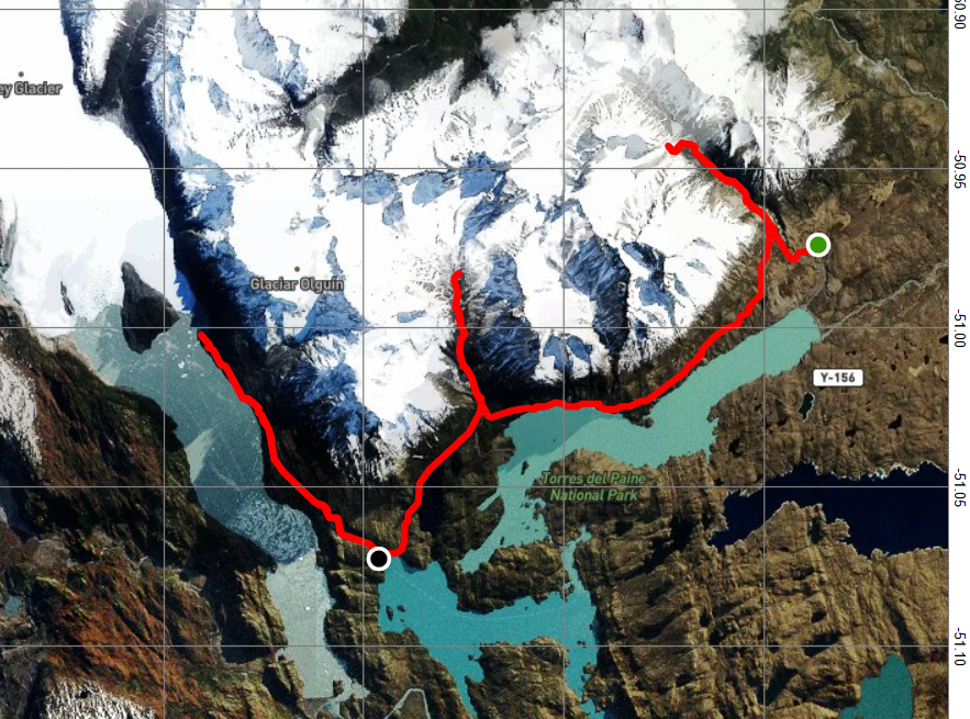
Our route is now planned. We are still doing the classic W as described in the Cicerone Guide, starting at the park entrance in the east and hiking generally (if not always directly) westward; first to the Towers of Paine, then moving on to the French Valley and the Horns of Paine, and finally to the Glacier Gray area and back to the park entrance by means of the lake ferry.
However, we have somewhat altered our planned stops. The attempt to book the free Campo Italiano (Italian Camp), which at one point was the linchpin of the hike, has been abandoned. The parks campground reservation system has still not opened for the season (one park operator told us you can’t make reservations at all) and many online posts said it did not open until September last year.
This is simply too much of a gamble for us. We don’t want to make all our other bookings and then have one gaping hole in the middle. This is the same conundrum we faced with the TMB…make all booking in advance and be locked into a very rigid itinerary that cannot easily be changed; or, go with the minimum bookings and have a lot more flexibility, but also much more risk being shut out entirely if things book up.
As with the TMB, we have erred on the side of caution. Sylvia and Brian are not fast hikers; we will be carrying heavier packs than we did on the TMB, and while we expect the terrain to be somewhat less difficult, we think it a poor idea to begin a day not knowing if you will have to hike 8, 15 or 20 miles to get to where you need to be. We will go with a pre-defined itinerary and accept the downsides of that strategy.
We did briefly investigate the possibility of staying in refuges, which would allow us to carry much less weight. We also investigated a packaged itinerary for camping. Both Vertice and Fantastico Sur, the two vendors in the park not associated with the National Park Service (CONAF), both offer packages that include everything — meals, park admission and transportation.

We quickly abandoned both ideas. The refuges are mostly booked up, and even if they had not been, the value provided is somewhat debatable; these are rather crude dormitory buildings and the cost to stay at them is higher than at hostels in Alpine Europe. The amount of service you get for the price simply isn’t worth it.
The camping packages meanwhile are simply unnecessary. While it takes some of the guesswork and logistical work out of it, the packages also inflate the price of the trip by at least 50%. We found we could make all bookings that are in the packaged itinerary for half the cost.

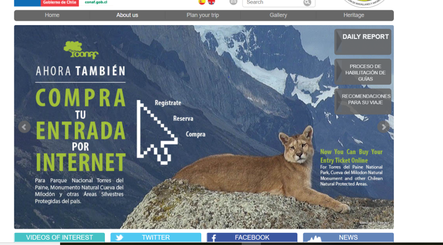
We found the online resources for booking to be highly confusing, especially the bizarre CONAF site, where it seems every link takes you back to a picture of a puma. Sylvia called CONAF, Vertice and Fantastico Sur in her attempts to find where the truth lies. From each, she obtained different (and sometimes conflicting) answers. Vertice, by the way, operates the camps and refuges on the western half of the ‘W’ (the West V?) and Fantastico Sur the eastern. The consensus seems to be that Vertice is the more polished and well organized, and that was our experience as well. But the LEAST organized, by far, is CONAF.
Our current itinerary looks like this…
DAY 1: Arrival and Towers: Arrive at park, shuttle to the area known as ‘Central’ (or sometimes just Torres, “Towers”) set up camp and then hike with minimal gear out to the Mirador del Torres and back in hopes of that iconic, illusive photo of the towers of Paine without a curtain of mist in the way. Because of the bus trip to the park the hike does not begin until late morning at the earliest, so we may not have time to continue on the Japanese Camp further up the Valley Ascencio. If we go only as far as the Mirador, this is 11.5 km (7.5 miles) out and back. This is a long and tiring day of travel and hiking.
Day 2: Horns. Hike from Torres/Central to the Refugio Los Cuernos, where will will camp beside the refuge. This is a relatively straightforward walk of about four hours which ends with a view of the Cuernos (Horns) of Paine. This short day figures to be the easiest of the hike.
Day 3. The French Valley: This will be the longest and hardest day of the hike, and the one where we may most lament our decision not to base in the Italian Camp (which would have made days 2-3 roughly even.) From the Cuernos camp we enter the French Valley, drop our equipment at the Italian Camp, continue on hopefully as far as the British Camp at the end of the valley, or at least as far as we can; then backtrack to our gear and continue on the W to the Refugio Paine Grande where we will camp. This figures to be a 7-8 hour day excluding stops.
Day 4. Lago Gray: The good news about day 3 being tough is that Day 4 will be relatively easy, with a straight walk up the valley of about seven miles to the Refugio Grey, which sits near the foot of the Glacier Grey. If we have the energy, we can take an excursion of some four miles to the best lookout over the glacier.
Day 5. Return to Base: About equally easy as Day 4, this simply retraces our steps back to Refugio Paine Grande where we catch the catamaran ferry to Pudeto, where we will hopefully catch a bus back to Puerto Natales.

Despite the modifications this is still very close to our original itinerary. The need to camp out four straight nights in the often brutal Patagonian weather requires coming equipped with our own tent, sleeping bags, sleeping pads and plenty of warm clothing. However, by camping in close proximity to the refuges we can have a prepared dinner and breakfast for each day. This adds to the cost, but saves us the need to carry a stove, cooking gear, fuel and a supply of food. It should also save us a bit of time which we can hopefully invest back into hiking, which is what we came here for.
Only time will tell if these choices were wise; same with our decision to attack the circuit very early in the season. Peak hiking season in Patagonia is summer, their summer being the opposite of ours. We will be arriving in very late spring (The ferry service actually opens just days before we arrive.)
Planning the trip in November should reduce the crowds and is more convenient for both our schedules. But it could mean less sanguine weather and more restricted views than in the peak summer season (January and February.)
Next, we’ll talk about the transportation challenges of reaching this remote area, and the unique advantages and pitfalls of our other destination on this trip…Los Glaciers National Park of Argentina, better known as Fitz Roy.
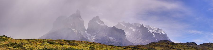
Featured image by: By RobertTarantino – Own work, CC BY-SA 4.0, https://commons.wikimedia.org/w/index.php?curid=74421536