Rocky Mountain National Park II: Deer Mountain
With the limited time we’d had on our first day in Rocky Mountain National Park, we’d still managed to bag scenic Emerald Lake. But with a full day to play with we wanted something more ambitious.
Brian had considered several all time Rocky Mountain greats including Deer Mountain, Mount Ida and Sky Pond. Sylvia’s cranky ankle (Crankle) had been seriously acting up again, to the point where she was actually wearing a brace on it. This, plus the spare kit we’d brought, made Brian reconsider his original preferred choice of Mount Ida in favorite of a somewhat scaled back Deer Mountain. But you couldn’t really go wrong with any of those hikes, all were reputed to be fantastic. We arose that morning from our pebbly floored tent to great weather; Brian decided on Deer Mountain, just up the road and in site of the campground, as the destination. We had passed the trailhead on the way in the previous day and thus knew exactly what to expect.


Getting to the trailhead was easy. But once there, Brian’s continued folly (or the continued curse of Blucifer) once again reared its ugly equine head. In a comic opera series of events, Brian became convinced that he’d left the spare battery to our Gopro back at the car when in fact he’d had it with him all along. A walk back to the car, a frantic and fruitless search, some ranting, arguing and cursing ensued, but at the end a frazzled Brian was able to find the allegedly missing gear and we continued on.
(But the comedy/curse was not yet over…as will become clear later on.)
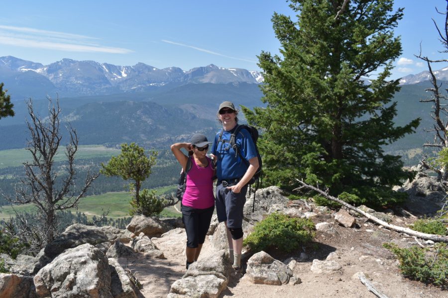
The Deer Mountain Trail is widely considered to be one of the best bang for buck views in the eastern part of the park, rising to a rocky ten thousand foot crag which dominates the surrounding terrain, and gives clear views of the majestic front range. Though it is wooded much of the way there are many open areas and lots of great views.

Leaving the road the trail turns up, crosses a broad open meadow with great views across to Morain Park, and then hits the first switchback, which is deceptive because if you are not careful the trail appears to keep going straight ahead. We passed a couple of girls coming the other way who had done just that.


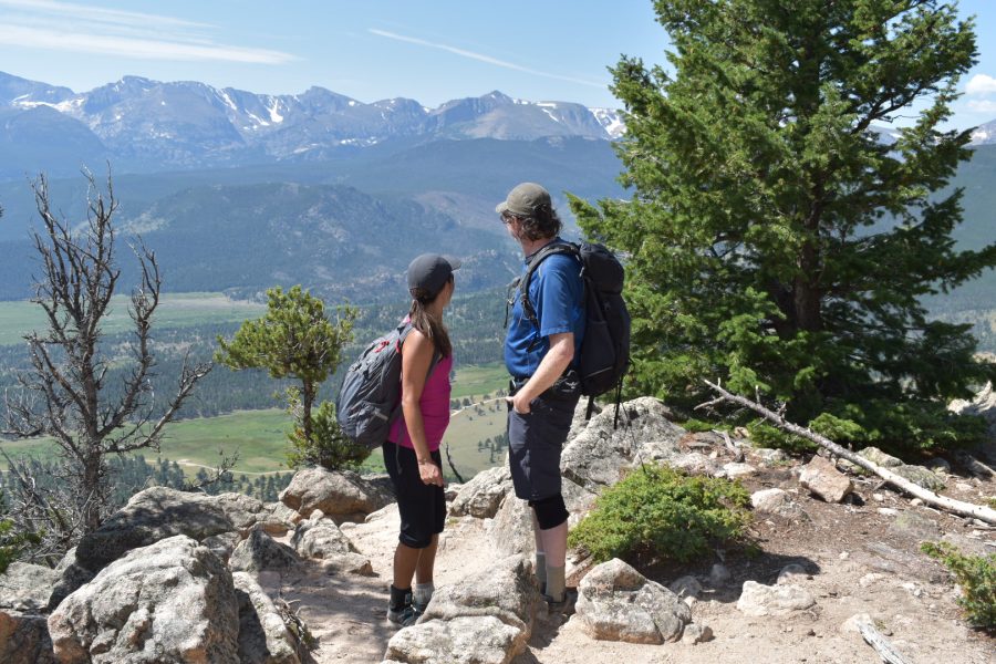
After two or three zigs and zags up the mountainside in open country, whith increasingly great views of the Front Range and Long’s Peak almost all the way, the trail steepens slightly and heads back into the trees for a bit. Then it comes upon a rocky section where there are several partial views, or areas where views could be had with a little effort; concluding with one fantastic viewpoint on a rocky ledge. Here we paused for what seemed an entire photo shoot with the same pair of girls, who turned out to be sisters, handling the camera.
After this great spot the trail levels out, heads back into the pine woods and runs along a nearly flat ridge line, even turning downhill for a bit. This serves to give you a false sense of accomplishment that you’ve finished something when in fact you haven’t.
Soon enough there is a junction near a cleared area and a horse hitching post (horses were in fact in residence.) Here the trail breaks right for the summit and enters the most difficult stretch, making a straight line uphill with no switchbacks and some high step-ups. But still this isn’t very hard…the most significant challenge here is the elevation, which is now over 10,000 feet.
Soon the rocky summit comes into view. It’s actually not quite the open panorama we were expecting…the summit is maybe a 180 view at best, and three-quarters treed in. But there are still outstanding and unique views from the open ledges, including Estes Park, several nearby lakes, Moraine Park, much of the Front Range and of course, Long’s Peak. It’s a great place for a snack or even lunch.


We sat and enjoyed it for perhaps a half hour before finally making the easy descent to the road. We weren’t far from our campsite – we could see it from the top – but we figured to head directly into nearby Estes Park for some lunch and cold drinks.
At the bottom near the trailhead, we discovered that once again Blucifer’s curse (or Brian’s deteriorating mental state) had struck. Passing the last turn before the car Brian noticed what appeared to be a makeshift sign, consisting of a hiking pole adorned with red and white ribbon of some kind. Well, he thought, looks like somebody must have forgotten a hiking pole here and somebody was kind enough to pick it up and make a sort of marker.
Until he realized that the pole in question was a Leki trekking pole that looked JUST like his. And that his second pole, which was supposed to be secured to his pack so that he could operate the GoPro, was in fact not where it was supposed to be. Brian stopped, put two and two together and finally, reached down to retrieve the pole he did not even know he had lost.
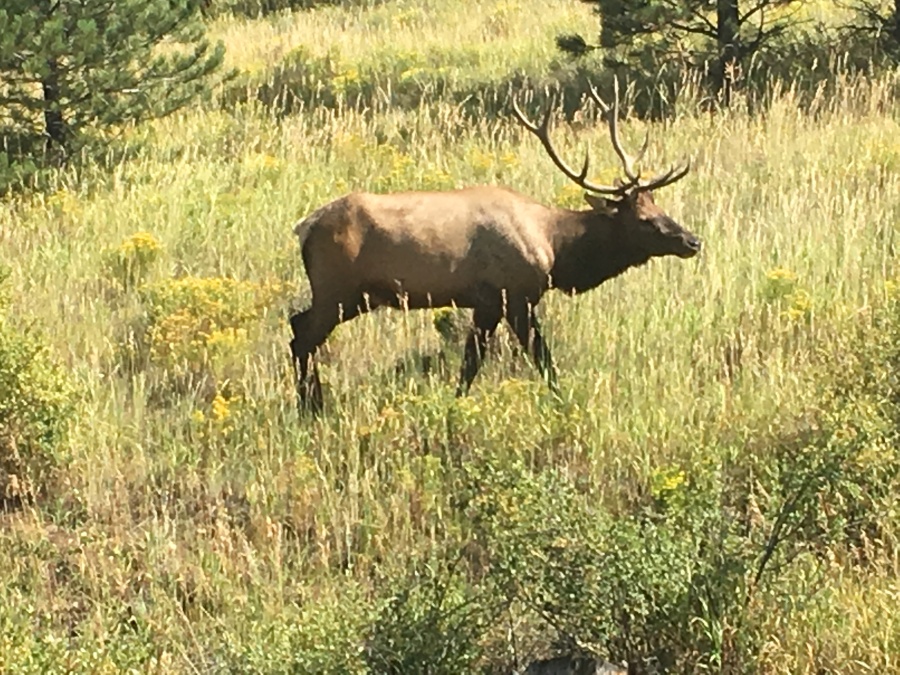
All ended well. Even the curse of Blucifer could not prevent this from being a great hike. All told it took us less than four hours to make the whole trip…we spent the afternoon in Estes Park sitting by the creek and having lunch, watching whole herds of elk meander by. And marveling at the beauty that is Colorado.
We would strongly recommend the Deer Mountain trail to any fit hiker who is not unusually impacted by altitude. It has an unrelenting grade in places and is somewhat eroded in others but is nowhere unusually steep or rough. The last fifth of a mile or so was the toughest section, but even this was not very tough. Just keep in mind the elevation at the top (over 10,000 feet.) Also bear in mind that Sylvia and Brian saw no water along this trail at any point, and the exposed sections could be hot in summer. As a final note, you may be sharing this trail with horses so be alert.
We do think there are doubtless better and more extreme trails in the park (Mt. Ida, Sky Pond, Chasm Lake and for the very adventurous, Long’s Peak) and we fully intend to return for them as soon as we can. (Sylvia is presently pushing VERY hard for Long’s Peak.)
As to our trip, we were not done yet by by any means…in fact a surprise was coming!
