TMB Day 11: La Flegere to Les Houches
*The Tour du Mont Blanc is the most famous and celebrated hike in Alpine Europe and is the fifth Bucket List Hike that Brian and Sylvia have completed together. It is also our first hike together of any kind in Europe.*
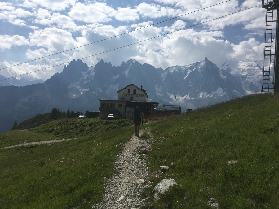
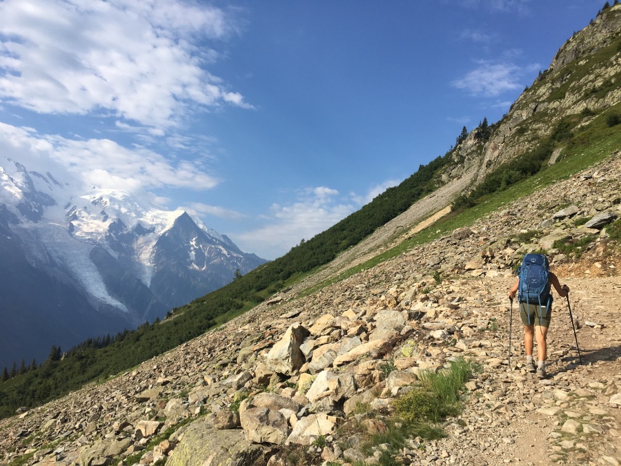
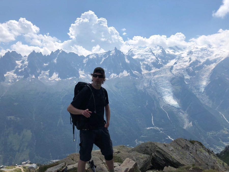
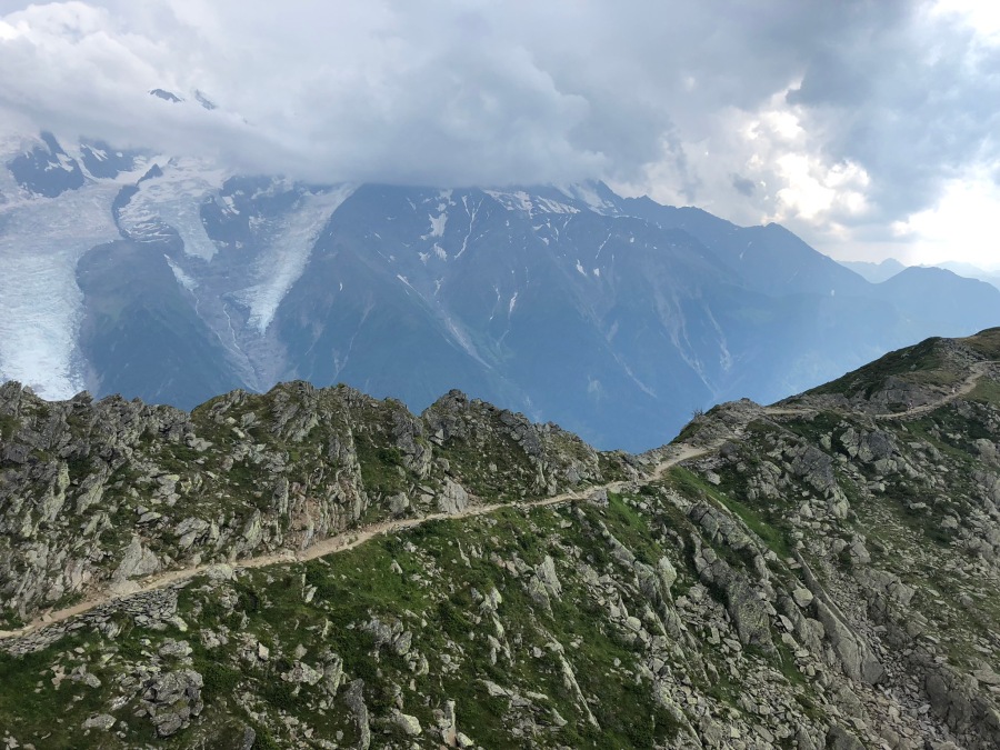
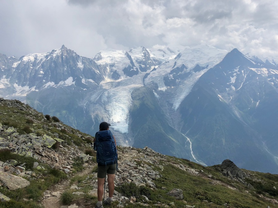
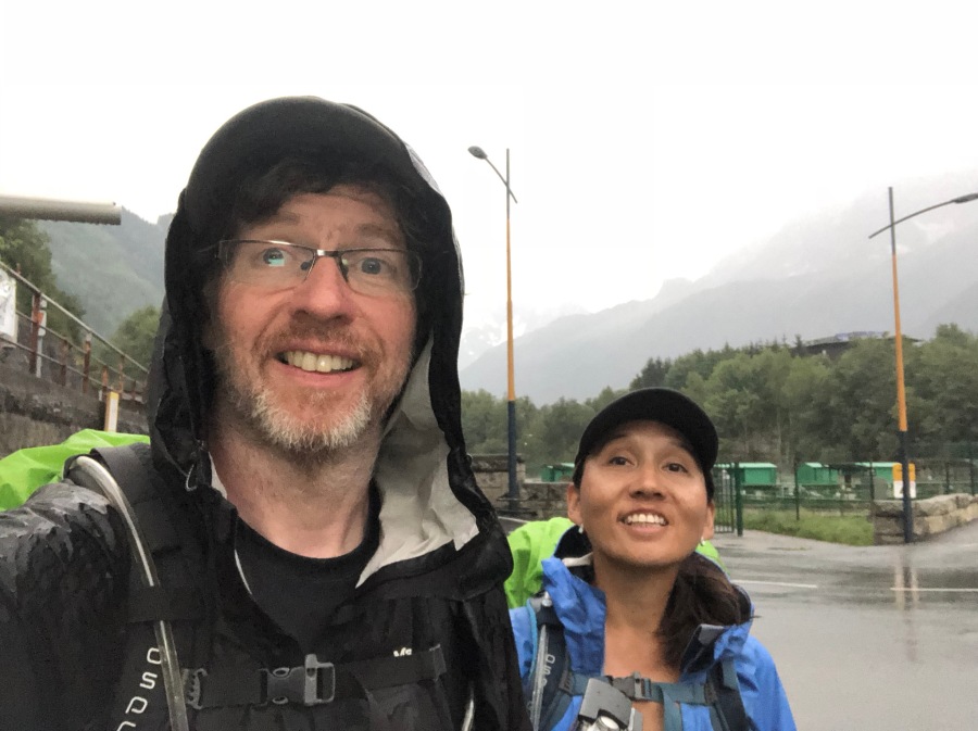
It was here at last. The final day of our trip, dawning gloriously. Rain was forecast later on; but for the most part, we would enjoy good weather for the conclusion of our hike along the Grand Balcon Sud.
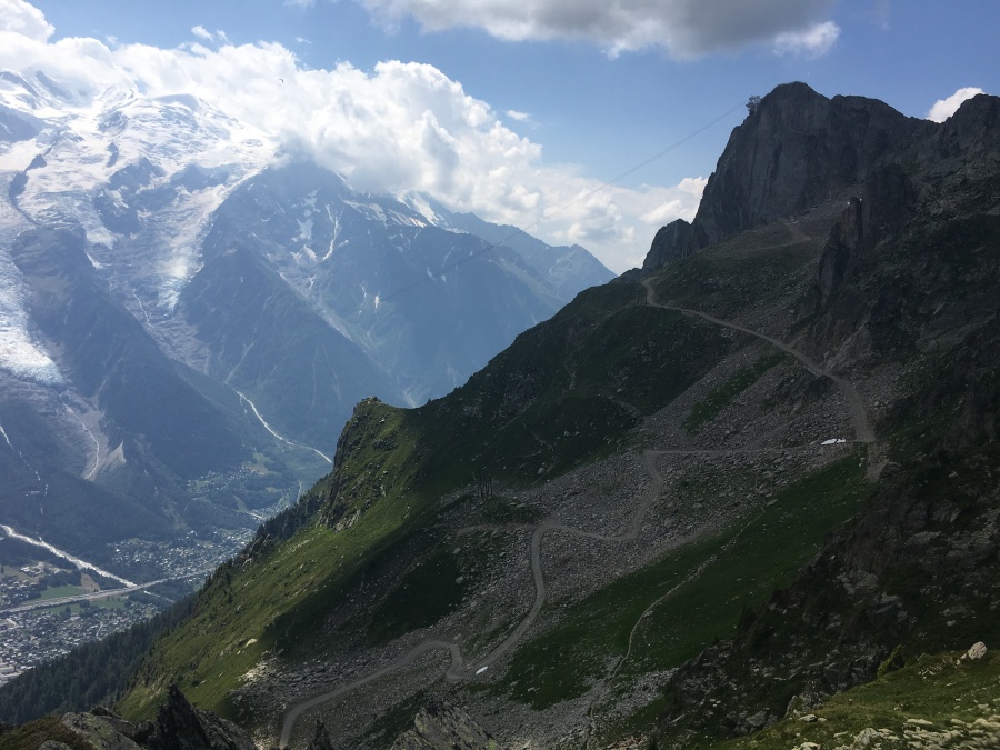
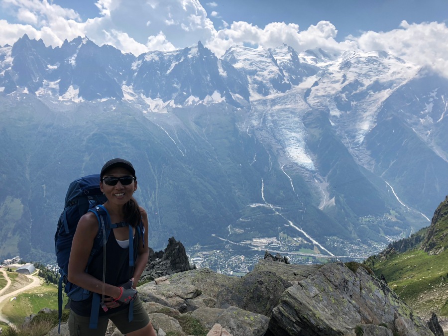
Below us we could see the city of Chamonix, almost in another world. This is where we were bound, at the conclusion of this day last day of hiking. In fact, we could have hopped a cable car right from La Flegere and been in downtown Chamonix in just minutes…from which it’s just a short bus ride back to our hotel.
But that wasn’t the plan. We were determined not to cheat even once on this hike. The Grand Circle of the TMB had to be completed just as it had begun…on foot, in its entirety. Brian and Sylvia would return to Les Houches the right way, by hiking to it.
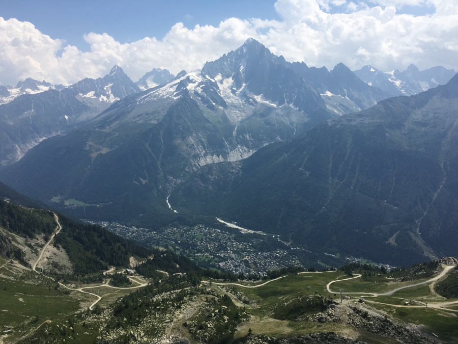
Today’s hike we knew to be a formidable one. There was a long and undulating walk to the Plan Praz ski area, followed by a considerable uphill push to the Col de Brevent, a short traverse of rough ground to the Brevent lookout point and cable car station (where we would again have the option of escaping by gondola) and then down, down, down – nearly 1500 meters of descent back to the village of Les Houches to complete the circle.
Most people prefer walking down to walking up. But the experienced hiker knows that while downhills might seem easier, they are far more physically taxing on the body than hiking uphill, as well as being far more dangerous. Most serious falls happen when going down.
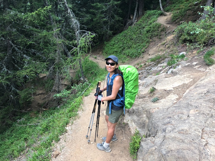
Brian, with his trick knee, always hates the downhills. And the both of us were nursing Crankles, which would not make it any easier. To top things off, a forecast of bad weather later on made it imperative that we pass the more exposed sections by mid-afternoon.
The M.E.P. figured on a tough but entirely doable day of hiking. Perhaps eight hours worth. We had a good plan, after all…recalling to the M.E.P. the plan Lee Marvin had shared to his troops in the classic film “The Dirty Dozen.” That plan, which involved blowing Nazi’s to Kingdom Come, had been summarized by a snappy rhyme that ended, “…And we all come out like it’s Halloween!” And so would we, at the train station of Les Houches about eight hours hence. If all went according to plan.
As oft happens, events would show this plan to be hopelessly optimistic. The M.E.P. would have done well to remember that most of Lee Marvin’s men had perished along with the Nazis by the end of the movie.
But that was to come. Day eleven began with grand views, which continued for most of the way.
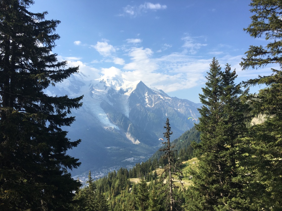
Much of the area between La Flegere and Plan Praz goes through country disfigured by ski slopes. Kev Reynolds positively turns red with outrage against this in his guidebook. “The most depressing sight of the whole Tour du Mont Blanc,” bemoans Reynolds. And there is no denying the damage the ski industry has inflicted on the slopes of these mountains.
I don’t wish to deny anyone their opportunities for recreation…skiing is fun and a profitable business that no doubt brings millions of Euros into Chamonix every winter. But I do sometimes wonder why it is everything people seem to need and enjoy has to be so disruptive to the landscape. It is said that nature abhors a vacuum…but people seem to abhor nature and replace it with a vacuum. Why must that always be so?
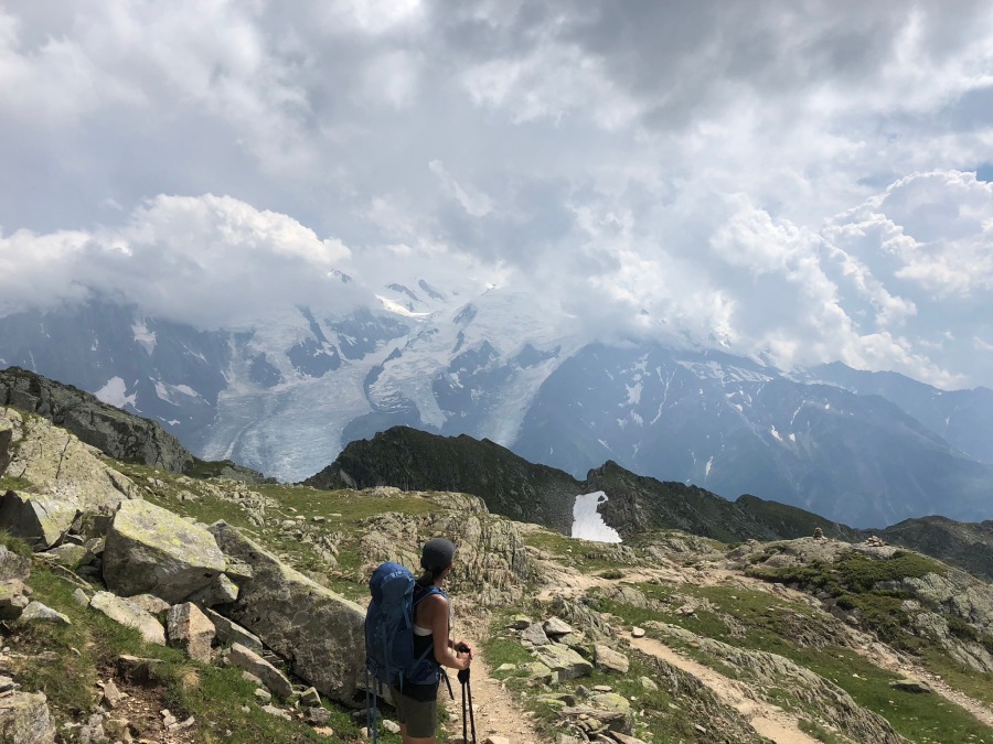
At any rate, there are still great views of Mont Blanc everywhere, ski paraphernalia or no.
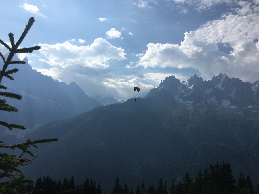
There is also quite a large contingent of people doing paragliding from the Plan Praz area. So many, in fact, that I kept expecting to see somebody plunge out of the sky in some terrible accident…but it never happened, so these people must know what they are about.
Somewhere around here we apparently got turned off the main trail, and ended up below where we thought we were supposed to be (there are scores of herd paths in this area.) We could see hikers above us, and this was mildly annoying, but on the other hand we could also see that our path and theirs were going toward the same place, and thus decided to wait it out.
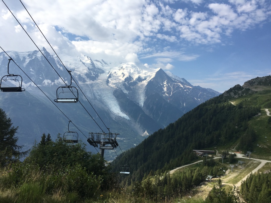
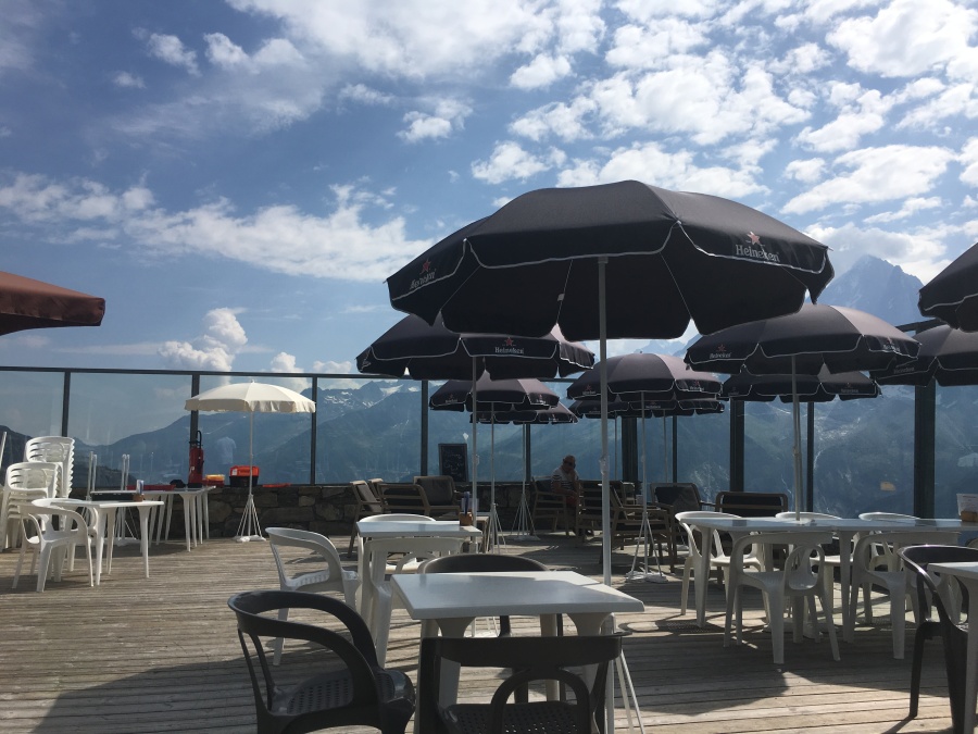
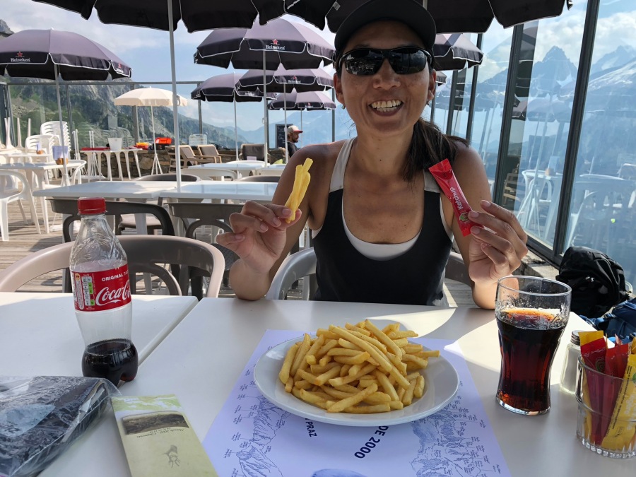
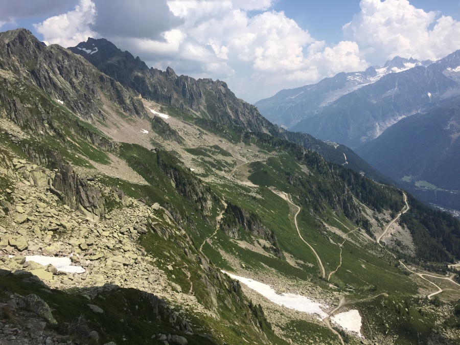
Near the Plan Praz cable car station – one of three we would eventually pass that day – we decided to stop and have lunch, rather than wait until Brevent. This turned out to be a good decision, since the trail ahead would prove demanding and the facilities of Brevent somewhat substandard. Sylvia was dying for papas fritas (French Fries.) We sat on the Plan Praz deck eating and enjoying the view, watching the paragliders take to wing.
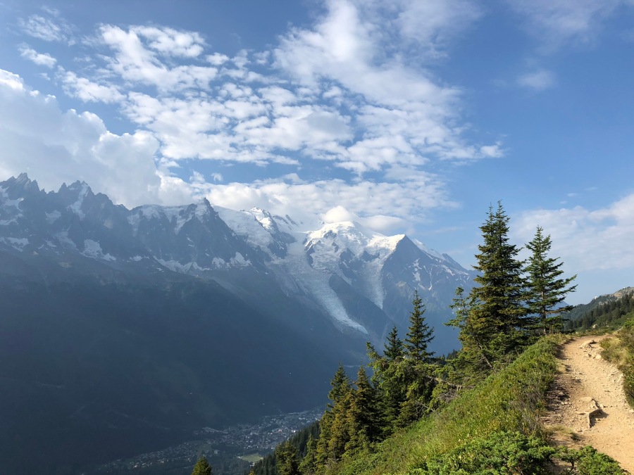
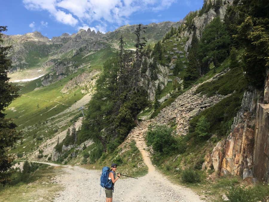
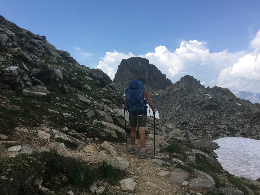
After lunch we set off again for Brevent, the last ascent of the tour. This is an intense stretch of trail indeed…first, there is a slog with great views all the way to the Col de Brevent. Here you get good views of Brevent summit itself, looking quite distant and ominous…though it is only 45 minutes away by the book.
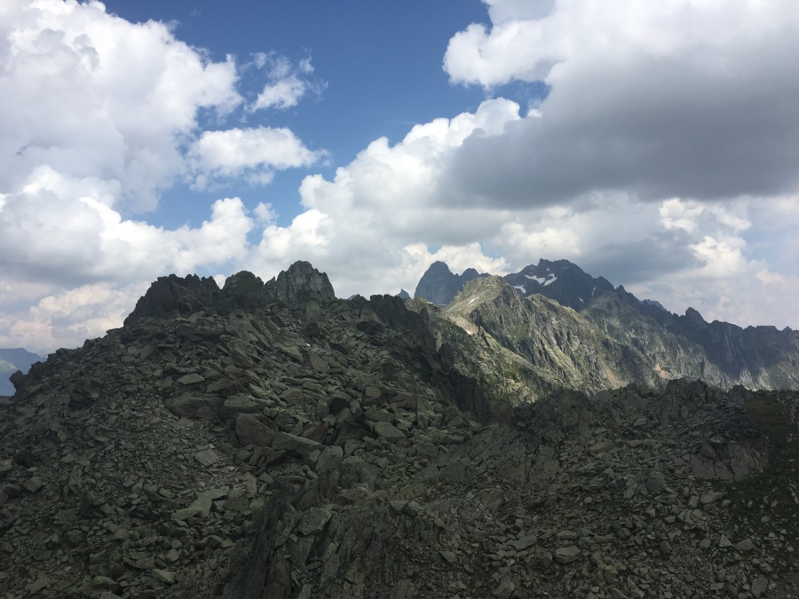
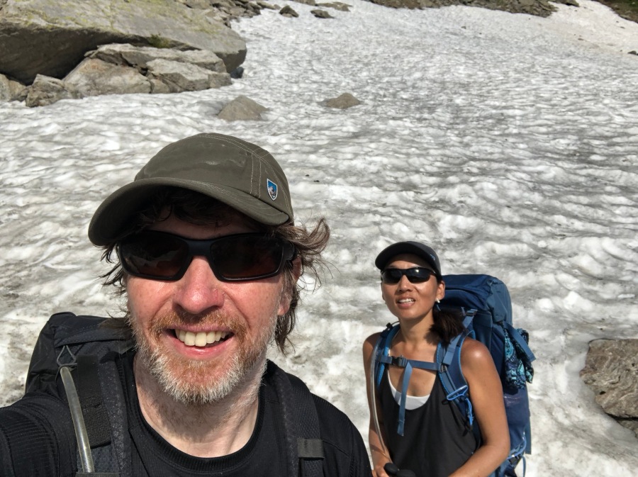
Here in the col lingered some late season snow, which we crossed easily. Also, there are interesting views to the other (Northern) side of the Aiguilles Rouges…country we had not seen since until now, the mountains having been in the way.
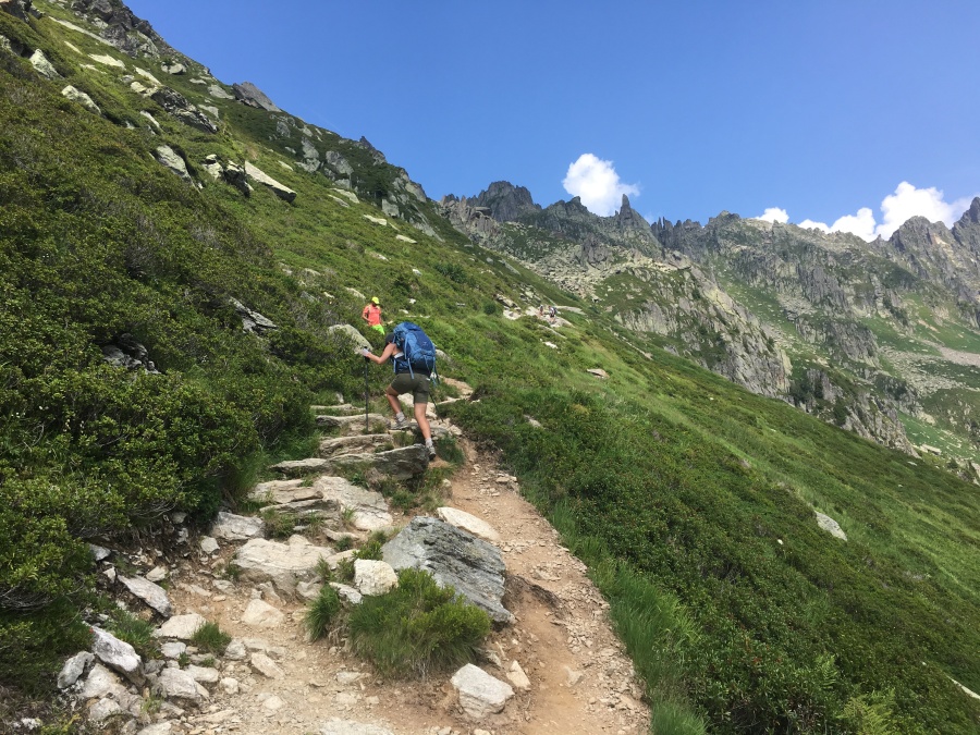
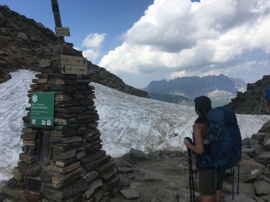
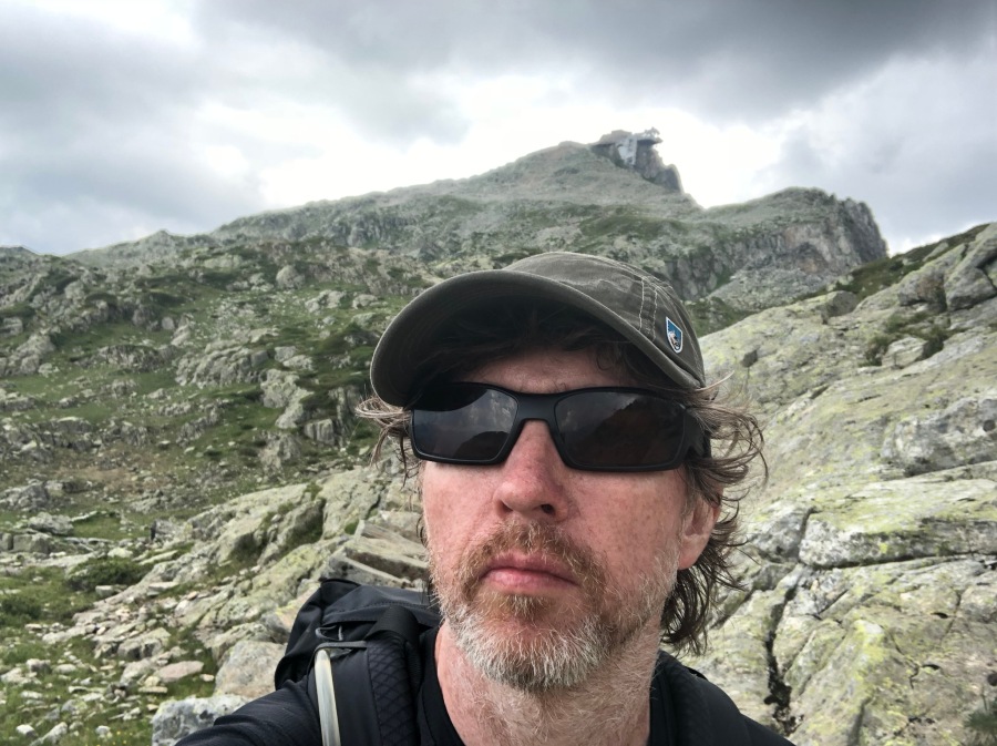
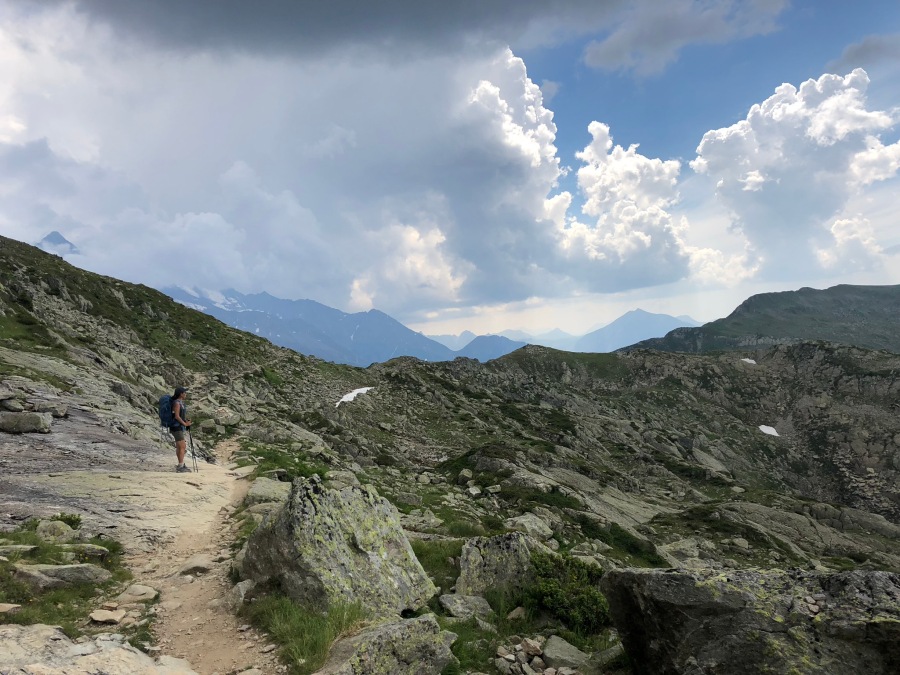
It was also just past here that things got a bit interesting. Between the Col du Brevent and Brevent proper, there is a stretch of high, broken and somewhat confusing ground. Kev Reynolds, in typically understated fashion, calls this area “…an enclosed hollow, where…vision is severely restricted.”
This is not inaccurate; but it is sort of like calling the Sahara Desert “an area of sand where risk of sunburn is severely enhanced.” The span of ground between the Col Brevent and Brevent summit was, for our money, the trickiest bit of ground we saw on the entire tour, much more difficult than the celebrated Passage Délicat. (Note that we skipped the Col de Tricot and the Fentre de Arpette; it is entirely probable that either of them, especially the latter, is far more difficult.)
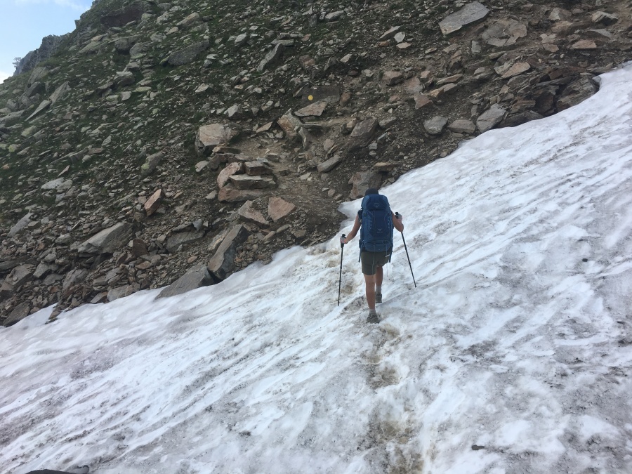
Down in this ‘enclosed hollow’ one gets some views across the wilderness of rock to the north, but Mont Blanc itself is almost entirely out of view, and strangely, there is not one single glimpse of Brevent at all (it’s close but on the other side of the mountain.) The footing is at times quite rough, rougher even than the ground between the cols Bonhomme and Croix du Bonhomme on Stage Two (which we passed in bad weather.) At times the trail goes right over shattered rock ledges and is quite hard to follow (at one point a fellow hiker turned to us for help, unable to see where the trail went next.) You have to look VERY CAREFULLY for the blazes here.
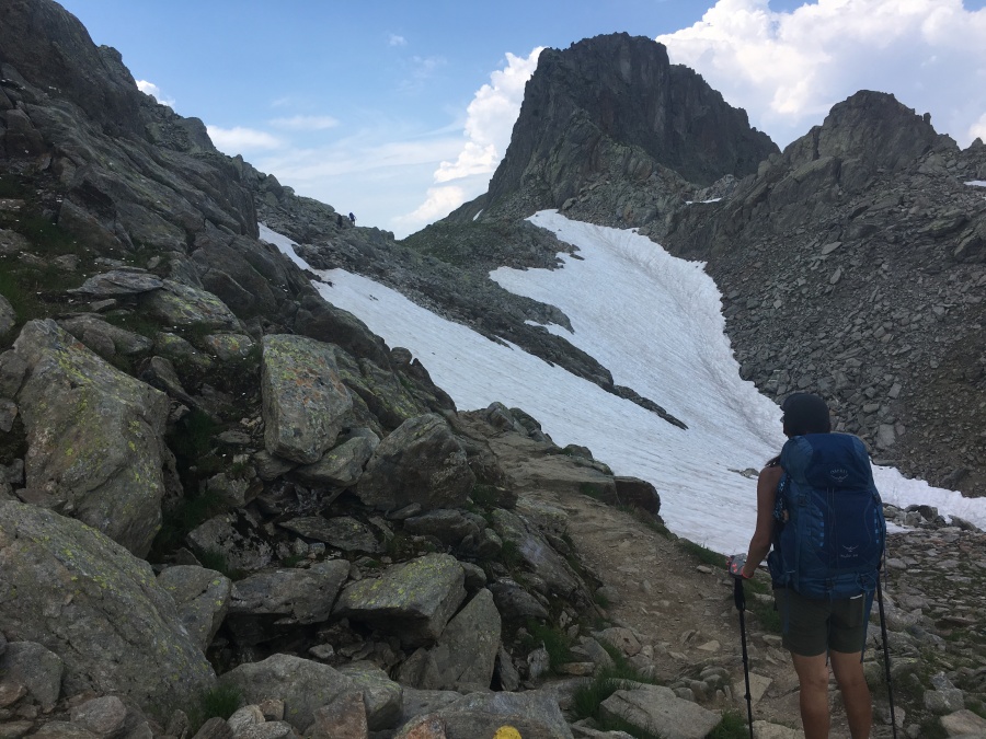
There also chanced to be a rather large field of snow lying here, tilted at a rather steep and unfortunate angle…this was the ONLY patch of snow on the entire tour that gave us any trouble at all. The trail scurried right across the top of this patch, which was a good hundred yards in length, and a fall here would likely mean a long slide down to the rocks at the bottom. And it was quite slippery.
We had some dicey moments on this crossing…particularly where the snowpack was interrupted by a large rock outcropping, which we tried to cross rather than go around (which in retrospect would have been smarter.) This led to some disconcerting maneuvers as we tiptoed across loads of unstable, clattering scree. While we fumbled about, a woman accompanied by an eight year old child passed us in the other direction, looking completely terrified. They made it across, though, and so did we. This, and not the ladders, was probably the most delicate passage of the entire trip. Still far below the level of difficulty where an ice ax and crampons was needed, certainly, but still a bit hair raising.
Oh, and about those ladders. Here there was another. ?
This one was pitched against the rocks at an odd angle of about 45 degrees, crossing a series of rock ledges, and Sylvia pronounced it the most difficult single ladder of the trip. Brian mostly agrees with this, though he did not find it anywhere near as chancy as the snow field.
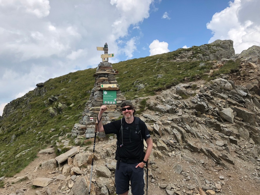
After the ladder the trail crosses a few more ledges and finally reaches a marker which officially announces that you have arrived at Brevent…even though it’s still a good five minutes further uphill. There was some more snow lying here on this first day of August, but the trail past the marker merges with a wide dirt road which presents no difficulty…there were in fact children playing on it.
At the marker we stopped to give directions to a pair of British hikers asking the way to La Flegere…we appraised them of the challenges ahead. A few minutes later, we had to explain it all over again using sign language pantomime to a pair of French hikers.
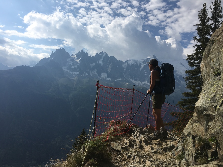
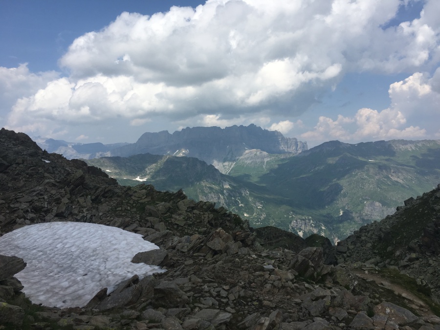
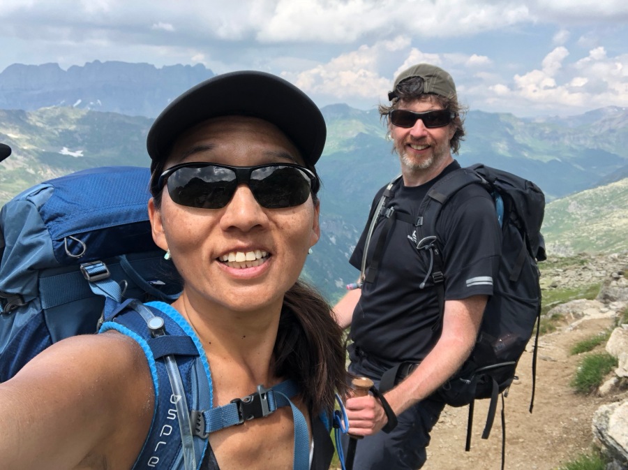
After this short uphill we arrived at the summit of Brevent. We were a bit underwhelmed by it, to be honest…there were the usual crowds of people wandering about, and while the view of Mont Blanc from here IS staggering, well, we’d been seeing the same view for nearly two days.

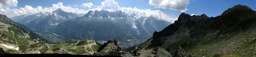
Brian is of the opinion that what makes a great viewpoint goes beyond just what the eyes are looking at. It also depends the mental state of the viewer…does the person feel relaxed and at peace, completely at one with the view? Does he or she feel as if they are merely looking at something, or actually a part of that something?
As in Lac Blanc, here at Brevent Brian felt the crowds put the objects in the distance at an even greater remove. One does not feel part of the landscape, but more like a visitor at a museum looking at something fine encased under glass. At Brevent the feeling was further strengthened by the noisome cable car, snack bar, observation deck and other man-made objects attached to or hewn from the rock. An impressive place to be sure, but not one that endeared itself to either of us. It was not one of our favorite spots on this trip.
But whatever its shortcomings, Brevent marked the end of our climbing on the Tour du Mont Blanc. From now on, every step we took would be downhill.
We sat in the snack bar a while resting and regrouping after the tougher than expected crossing of the ‘enclosed hollow.’ Brian, the Minister of Expedition Planning, had much on his mind. It was already after three o’clock, later in the afternoon than Brian had expected to be still lingering at Brevent. Thunderstorms had been forecast in the afternoon, and in fact many dark clouds had gathered over the back side of the mountain. Below us lay a vast alpine wilderness of highly exposed terrain; not as bad as the broken ground we had crossed earlier, but still quite open to the full fury of any sudden electrical storms. Brian wanted to be down well below Brevent, which stuck out from the mountain like a gigantic lightning rod, before the storms hit.
There remained the option of the cable cars. We had been told by several people (including a couple of seasoned hikers from Michigan) that we were basically nuts to walk all the way down to Les Houches when a perfectly good gondola ride was available. Brian knew that if we simply boarded the gondola (and paid the fee) we would be down in Chamonix in just twenty minutes, safe and sound and dry. If on the other hand we walked…
But the weather was holding, and we were determined not to cheat. Had there been lightning and thunder, the M.E.P. might have chosen the safer route…there never was any question of us doing so otherwise.
We hefted our packs, said goodbye to Brevent…and proceeded…
Down.
To where we’d all come out like it’s Halloween.
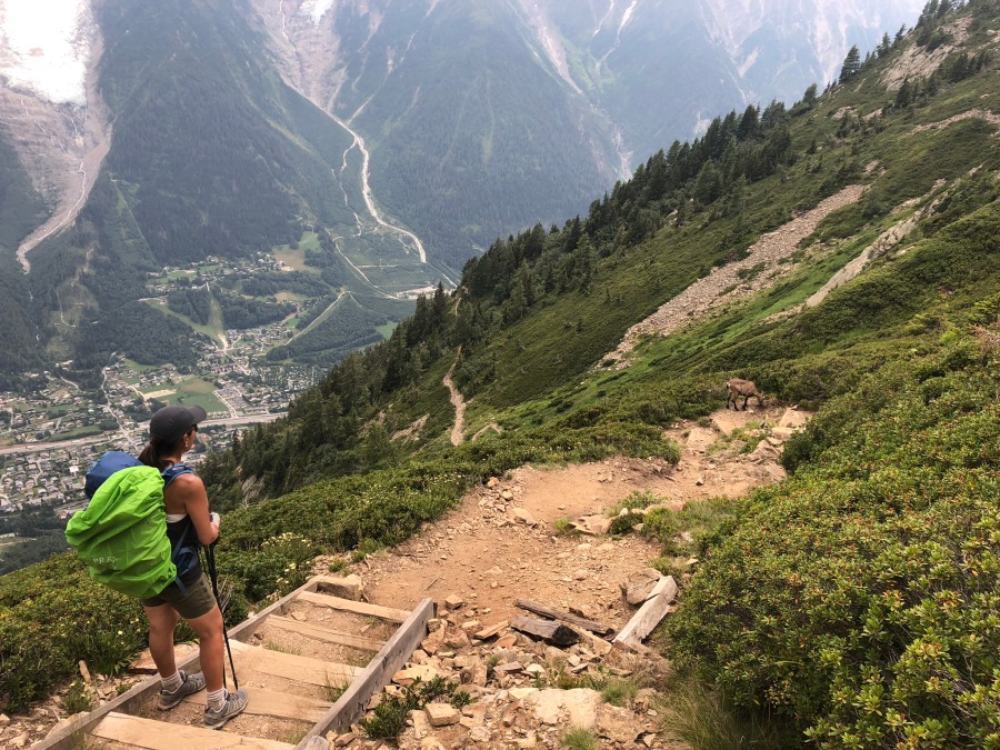
Describing the final downhill into Les Houches, Kev Reynolds practically becomes despondent, calling it “Knee wrenching…tiresome…never ending…among the steepest…of the whole circuit.” In fact, none of that even begins to capture the full scope of the tragedy that is this descent. But we’ll get to that shortly.
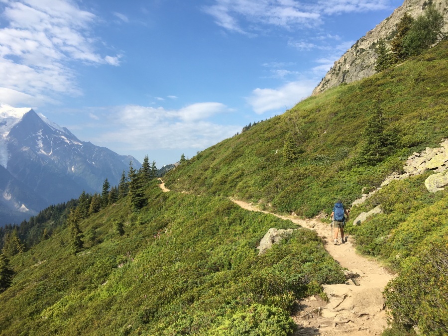
The trail as it heads out of Brevent is not really that steep, but we did have some trouble figuring out if we were on the right path. It was obviously a path to somewhere but there was no TMB marker, and the trail was signed only to Bellachat, not Les Houches. Many hikers were coming up that way, and I had to ask at least four before I was satisfied that, yup, this was the TMB. Once that was settled, it was just down and down and down.
And down. The trail loses altitude quickly, and by the time I heard the first ominous grumbling of distant thunder, we were undulating across the rocky folds of the plateau below Brevent. Behind us we could still see the cable car station frowning down from on high. There danger of lightning strikes was still present but far less here than up on the peak. We still had a long way to go to tree line, but the rumbling thunder came no closer for the moment.
Down and down. Past a wide tarn known as the Lac du Brevent, where various herd paths cross…past this point we saw very few hikers, as we were leaving the comfort zone of what could be easily reached by a short jaunt from the cable car. It was a somewhat strange, lonely, and spooky place, and yet we didn’t feel alone…our Buddy was right beside us.
Sometimes the trail followed a zigzag course through the rocks and sometimes it followed rolling ridges, with views straight down into the valley, and across to the Mer de Glace glacier and the main summit of Mont Blanc (now rapidly retreating into the clouds.) I actually preferred these peaceful views to the higher but far less mellow vantages of Brevent.
On down the trail went, and the fog closed in…very few hikers now, and these appearing suddenly, sometimes without warning from the mist. Soon we passed a German man coming uphill who told us the Refuge Bellachat, the very last one on the Tour, was just 200 meters further down. This was welcome news…not only was it a clear sign of progress (as was the fact that we could no longer see Brevet looming above) but also because thunderclouds were now swirling almost overhead. If a storm should break, the M.E.P.’s plan was to take shelter in the refuge and then proceed downhill only when the sky had cleared.
Brian very much enjoyed the brief stop at the Bellachat, which has fine views of the valley and Mont Blanc. In fact, if he’d had it to do over again, This Guy might have traded the rest day spent in Trient for an extra night there with a much greater view. Kev Reynolds in fact states, “…Unless you have good reason to continue…an overnight stay in this idyllic location is highly recommended.”
***Editors note: When this suggestion was run by the copilot after the fact, it unleashed a tirade which nearly resulted in a laptop to be hurled at Brian. Sylvia adamantly states that this refuge is “Not good” “too rustic” “primitive” had a “squat toilet” (that fact confirmed); is a “heuvada” (Spanish: ‘piece of crap’) and she would “Not stay in this place” under any circumstances. Apparently the M.E.P. and Kev are somewhat more easily pleased. End Note.***)
The storm backed away for the time being, and it was getting late; so after lingering at the Bellachat long enough to consume our last packages of Gu on the tour (we started with two dozen, ended with just a pair…the two remainders were both Vanilla) we donned rain gear and proceeded…
…down. We hoped that we did not have far to go. But these hopes were soon dashed as a sign just below the refuge informed us that Les Houches was another two and a half hours away. With that hope dashed, we consoled ourselves with the hope that sign was perhaps overly pessimistic.
But events would prove that it was, in fact, overly optimistic. Somewhere in the back of his mind Brian was repeating…And we’ll all come out like it’s Halloween!
Somewhere after the refuge the trail turns down into a large, washed out ravine that looks like it has been the location of numerous mudslides. Here, it becomes much rougher…several steep and dicey points along this part of the route, including at least one traverse of a narrow cliff where a chain assist is provided.
Here we had a serendipitous meeting. We had been looking all along for sightings of Ibex, which are considered quite common around Brevet. But we had seen none, and had by this point almost forgotten about them. But when we turned into the ravine and looked down, what should we see but a mother and baby ibex, loping across the trail below us! We could only envy the way the ibex leaped nimbly across entire sections of trail, going from one switchback to the next. Had we both been Ibex, the descent to Les Houches might have been over in a half hour.
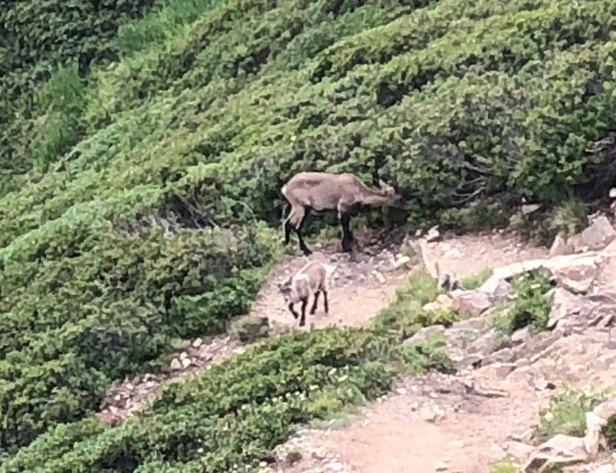
But we were not Ibex, and so down into the ravine we plodded. Our four legged friends kept station in front of us for a while, sometimes just twenty or so yards ahead of us.
Apart from the ibex we encountered almost no one on the section…perhaps four other hikers in total the whole way to the bottom, and these seemed as surprised to see us as we were to see them. Very few hikers seem to complete the entire circuit on foot…most aren’t nuts like we apparently are and use whatever other methods they can to cut out the hardest sections. Cheating, in other words.
At the bottom of the ravine we passed the worst single section of the descent…by which time it had started to rain, making the rocks more slippery. Again Reynolds makes note of this area, but in quite abstract language. At a spot where the trail practically wades through a small stream on muddy rock slabs, Sylvia lost her footing and slipped, then fell down completely. But fortunately she was not injured badly.
Apart from that one rough section, and maybe a couple others, no part of the descent was really that bad. It was rather the long and unrelenting nature of the descent, seeming to go on and on forever, that caused it to be so very agonizing. Down and down and down it went…but every time we looked through a gap in the shrubs, the city of Chamonix below us looked a million miles away. When would we ever reach it? It’s closer than it looks, we re-assured ourselves. It must be closer than it looks.
But it was in fact every bit as far away as it looked.
At length the trail entered the trees for good, and at least we didn’t have views of Chamonix taunting us anymore. All we had was a trail that kept going down, now through a dark and foggy forest. The rain began to pitter down in earnest upon us. In addition to being sore and tired, we now had to contend with being wet as well.
At some point in our misery we looked up to see that we had arrived at the outskirts of the Merlet Zoo, which lies just above Chamonix. Here was a blacktop road, a parking lot, cars, people wandering about…finally we were there! The hike was just about over!

Wrong. The signs dutifully informed us that, while we were somewhere, that somewhere was still nowhere near where we needed to be. Les Houches (Where we would all come out like it’s Halloween) was still a mind-numbing hour and twenty minutes away.
We trudged on through pouring rain now. Off the blacktop and back onto a steep and muddy trail again, almost unbearable agony on tired knees. At about an hour from of Chamonix we ran out of water. By that point, Brian was already past the limit of his endurance and was shambling forward on autopilot. And still, we were not there yet.
Along this wooded and forgettable section of trail, a memorable thing – the last memorable thing of the hike – occurred. We stumbled into a clearing where a huge statue of concrete poked its head out from the trees. This was the statue of Le Christ Roi (Christ the King) which is plainly visible from the town of Les Houches. Here also is a small chapel and open air alter.
As we stood watching, Brian took note of a strange sound, as if someone were pushing a cart with a broken wheel up hill. Almost immediately – BONG! — a bell rang out, and we realized that the strange sound had been the machinery of the clarion beside the statue, gearing itself up for the evening serenade. The bells rang out clear through the whole valley (they can be heard for miles.)
We had happened upon the statue and it’s choir of bells at the perfect moment, and were completely alone with it in that moment. What a moment it was! The bells continued to toll for a good five minutes as we descended, making the wretched slog just that much less intolerable. Thank you, Le Christ Roi.
Nothing else memorable would happen until we emerged wet and exhausted from the trees about thirty minutes later, nearly eleven god blessed hours after we began, and finally saw before us through the misty twilight the train station of Les Houches…the exact spot the adventure had begun two weeks earlier. The circuit had been closed, the grand circle complete. We had finished the Tour du Mont Blanc, walking it every step of the way!
Like a couple of strange costumed apparitions emerging from the fog, we’d indeed come out like it was Halloween.
Sylvia immediately burst into a celebratory dance, leaping about in complete, giddy excitement. Brian, much nearer to physical collapse, was in no mood for dancing. The M.E.P., who had first conceived the idea of the tour, and had been looking forward to it for years, was now glad only that it was over. Exhausted, wet, in a foul mood, generally grouchy and ready to toss Kev Reynolds in the recycle pit, he wanted only to be transported instantly back to the hotel so that he could sleep for a about a week. As he sulked in the shelter of a train station kiosk, it was Sylvia who did the celebrating for both of us. She alone realized that we had done something extraordinary!
But we were still not quite done walking. With no sign of the shuttle bus, we began plodding down the same road where, fourteen days earlier, the great suitcase derby had taken place. It took us fifteen more minutes to schlep back to the hotel, where finally we showered, changed into dry clothing, and then re-appeared downstairs for dinner looking slightly more human. Then, and only then, did Brian’s ill humor improve. And then it dawned on him…
The Tour du Mont Blanc was over.
NEXT UP: The Grand Circle Complete!