Mount Jefferson by the Mountain Ridge Trail
*We have added Mount Jefferson to the list of best places to hike in the Southern Appalachians and Carolinas. Though there are several nearby places which are superior…Elk Knob for example…and many of the best views are reachable by car, it’s still well worth checking out.*
After a successful dog-human team hike of Elk Knob last week, we decided to go back to try another hike this same area of North Carolina. This one – Mount Jefferson – is actually long overdue.
Mount Jefferson State Natural Area, as it is called, was once one of the most westerly-lying of the NC State Park units. For years the state had done little to develop any sort of recreation or land preservation in the mountains, perhaps reasoning that it was the federal government’s responsibility. That thinking started to change about two decades ago, and many of the great new western Park units like Elk Knob and The Gorges are beginning to mature.
Mount Jefferson, however, has been here a long time. In fact, there’s been some sort of developed recreational area here since at least 1939, though it did not become a state park until 1956. If you guessed that it was named for this guy, you guessed right.
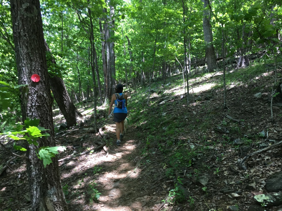
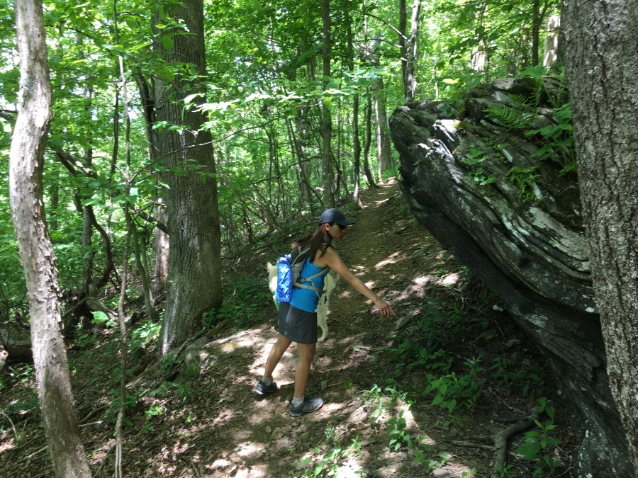
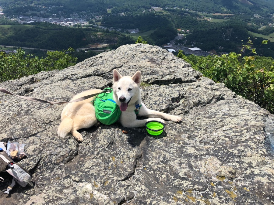
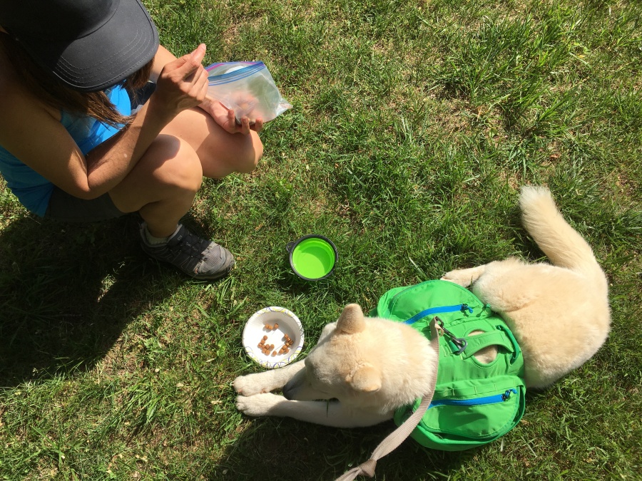
As with last week’s hike, we decided that the park’s trail system was suitable for a day hike with future sled dog captain and cash hound Fitz Roy. So we packed him in the car and off we went.
The day started off in interesting fashion with a wildlife sighting directly outside the garage. Sylvia sighted a full grown snapping turtle lurking in our shrubbery…we don’t know where he came from or went to, but we left him alone.
Because we chose to travel on Sunday, which seemed likely to be the least crowded day of the Memorial Day Weekend, we were not able to stop for our usual breakfast at Chik-Fil-A. Nonetheless, we reached the Mountain after an uneventful three hour drive. We like this corner of North Carolina – Ashe and Watauga counties – that sits just a few miles from the Virginia and Tennessee border. There a LOT of great stuff to do and see here which we’ll detail later on.
Mount Jefferson State Natural Area was designed – and its backbone facilities built – in an era when the idea of outdoor recreation in America was much different than it is today. In the mid-1950’s, it was assumed that when American’s recreated, they would do so by car; and that they would want to drive their newfangled internal combustion wagons right to where they wanted to go, and have a picnic there while enjoying the views, and that walking was for losers.
Thus, state and national parks of that era feature paved roads right to the views, lots of picnic tables, lots of paved walkways and concrete steps, but few real trails. Many US National Parks, and the Blue Ridge Parkway, were born of this “auto-touring” era.
The concept of outdoor recreation has changed a lot. Walking is no longer for losers; it’s now a pursuit enjoyed by millions, with a multi-million-dollar industry to back it up. We seldom see anyone at those fly-ridden picnic tables.
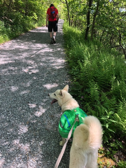
If you wish, one can drive directly to a spot just a third of a mile below Jefferson’s true summit, park your car and walk to the picnic tables. Sylvia, Brian and Fitz Roy did not wish to. Instead, we chose to hike it.
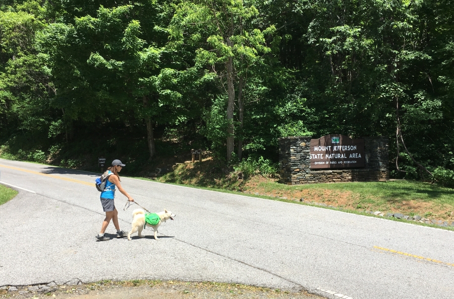
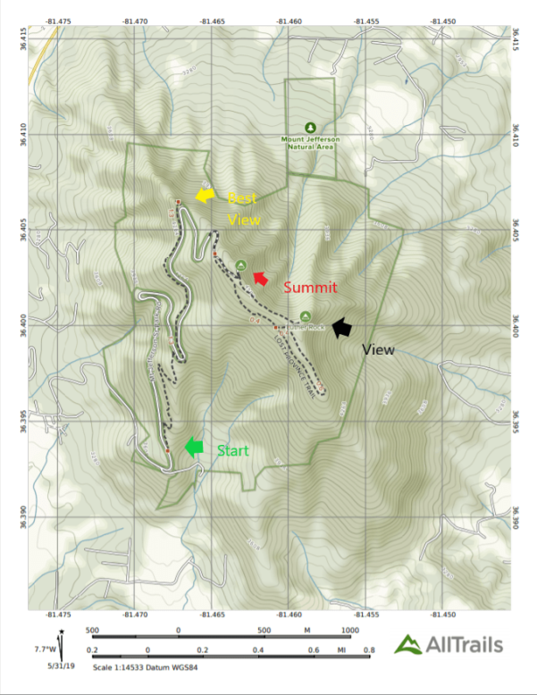
The Trail leaves directly across the road from the park’s visitor information center, which is basically a small building that houses the ranger station and maintenance shop. Other than a single bathroom and info kiosk, there is little here; the parking lot is tiny. Most people don’t stop here, they continue on up the mountain.
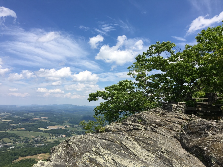
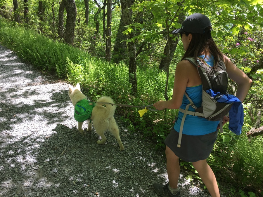
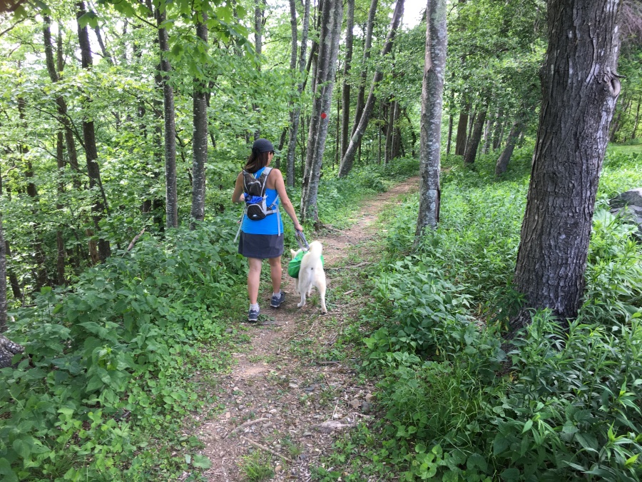
The first three quarters of a mile of the Mountain Ridge Trail is fairly easy, as it rises gently while passing through woodlands on the way to the first feature, the Sunrise Overlook. As the name implies, this overlook faces east, while its counterpart further along, the Sunset Overlook, gazes westward.
We found this overlook, which in true BRP fashion is now partially closed in by tree growth, to be underwhelming. It’s also right by the road, so the hiker will likely share it with a few carloads of gawkers. The Sunset Overlook, also hard by the road, seemed a little more open, though we didn’t hike to it this time.
After the overlook the trail drives back into the trees and begins to traverse a rather exposed flank of the mountain staying just below the road. This section is much rougher and is what causes the park to call the trail ‘strenuous’, though most hikers won’t find it so. The trail soon passes a junction with a spur trail that heads off to the Sunset Overlook, while the main route continues upward toward the summit.
There was a lot of noise form motors along this otherwise pleasant trail. We couldn’t quite see what was below us, but it sounded like a motor speedway.
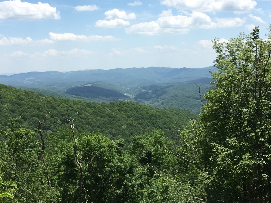
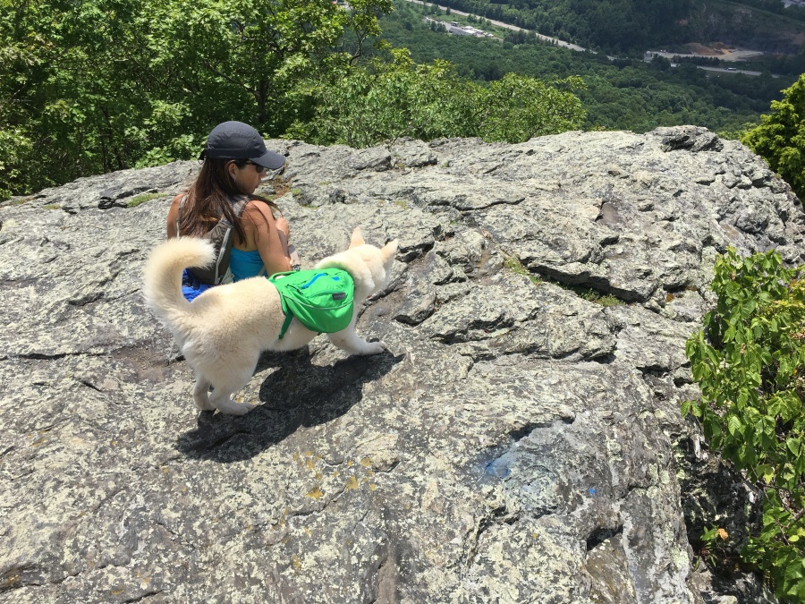
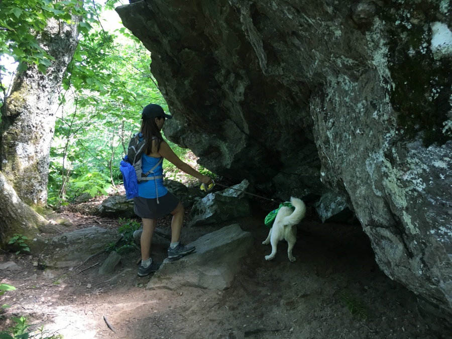
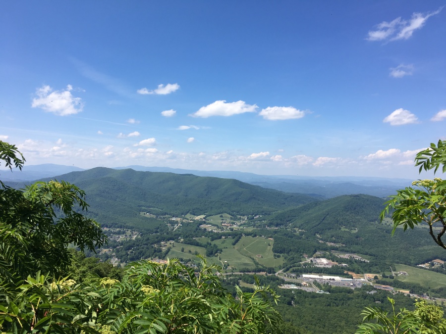
At the junction the trail enters its roughest section, which continues through bumpy terrain until it reaches a dripping culvert that comes in from the road above. Then it levels for a bit until reaching a split boulder, after which it enters a final rough and somewhat steep section that deposits the hiker at the tiny parking area for the Jefferson overlook – by far the best of the overlooks off the auto road.
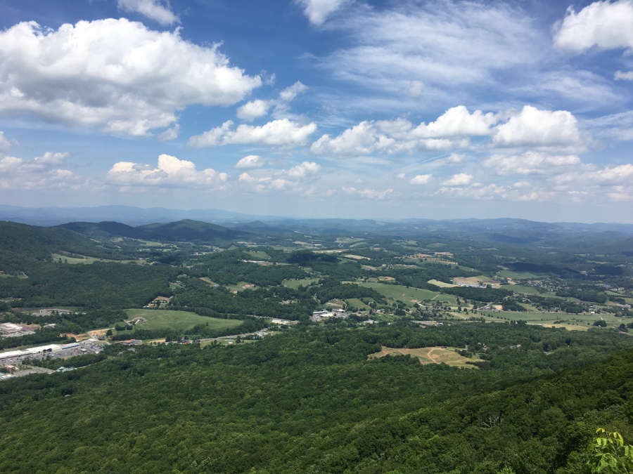
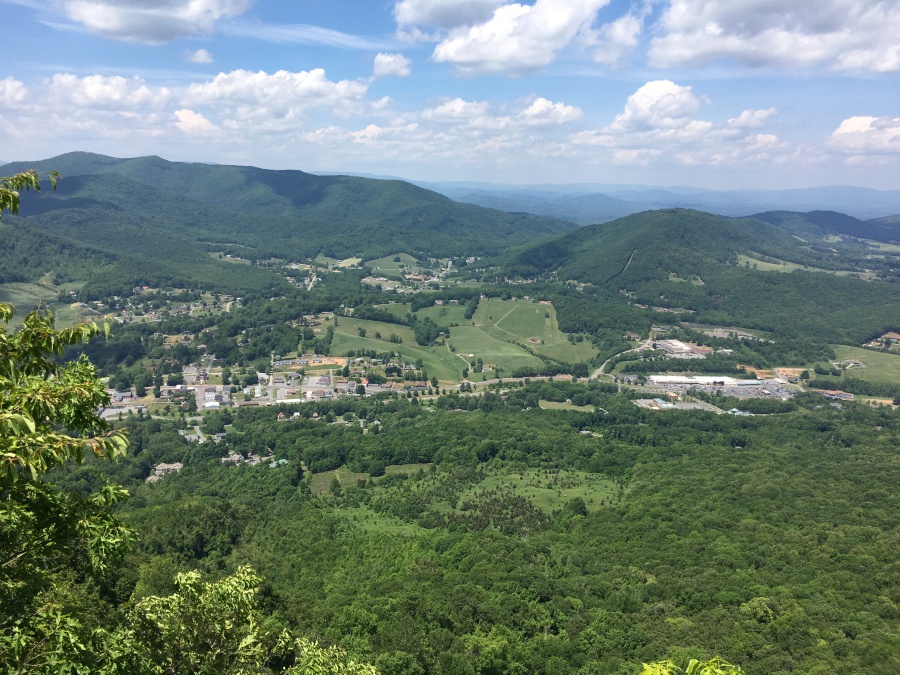
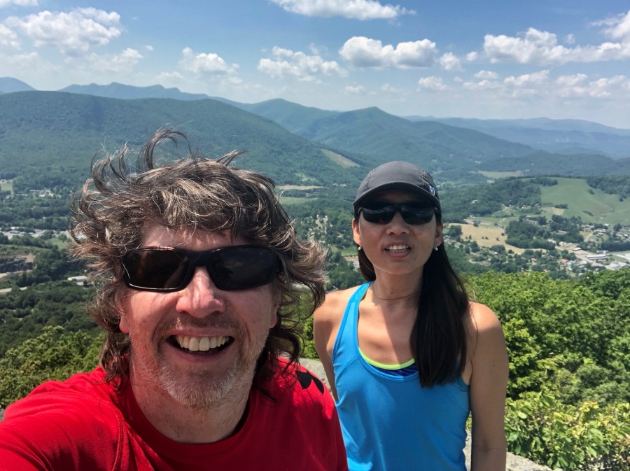
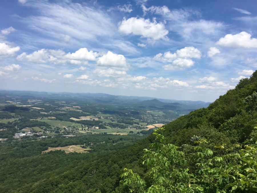
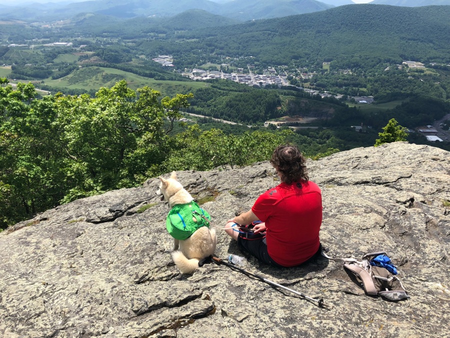
There is a wood railed balcony off the overlook that affords grand view into Virginia. But the best views are from a small rock ledge to the left of the pullout. Here we sat and enjoyed a snack and some water.
Here also Brian discovered that his ass was soaking wet, which is what happens when you carry an additional ‘canine water reservoir’ in your back pocket, and then forget and sit down on it.
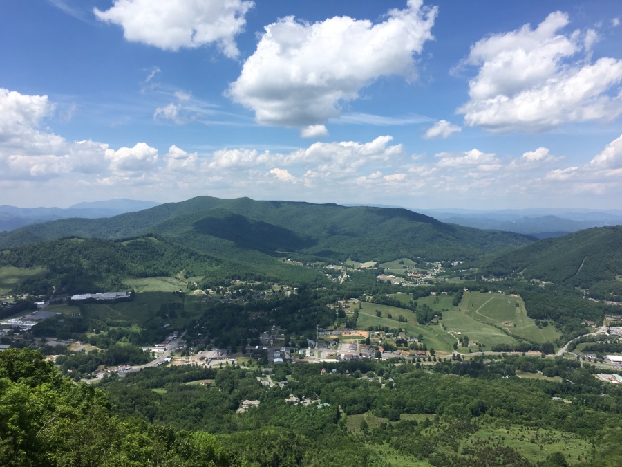
The ledge offers excellent view of the Town of Jefferson below, and the commanding ridges beyond. The busy town is where all that auto noise we heard on the trail was coming from.
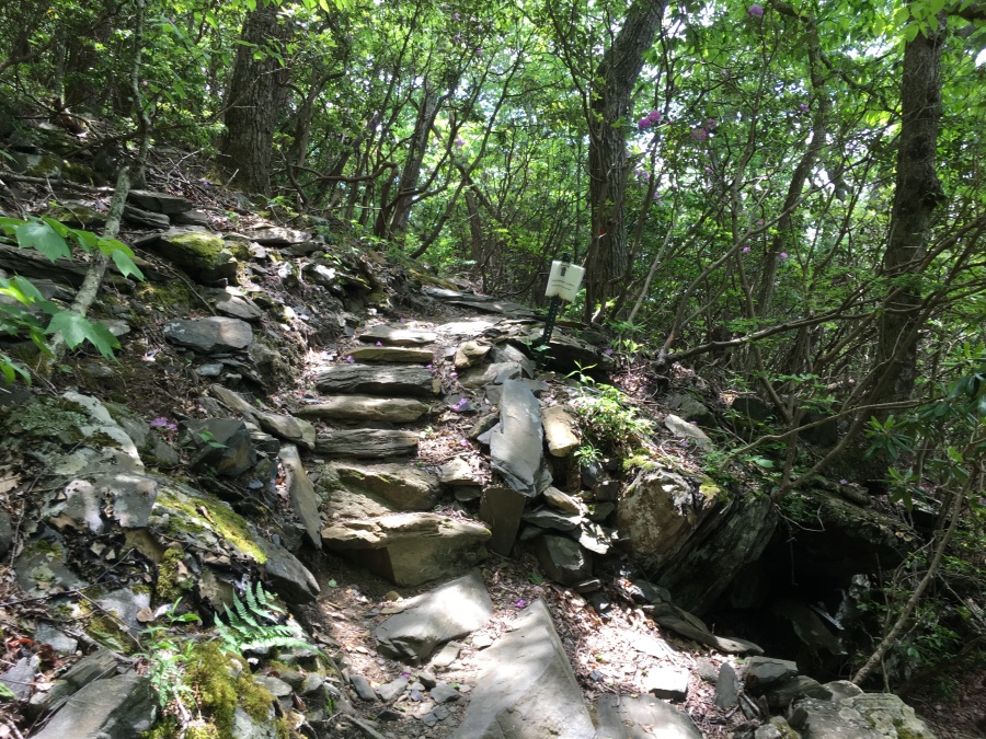
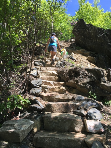
Beyond the Jefferson Overlook, there is a set of steep stone steps that leads directly up the slope. After this short ascent – the steepest part of the entire trail – the path again becomes moderate. Just past the stairs there is a partial view, then a side trail breaks left and leads uphill to what appears to be a building off through the trees. We surmised at the time that this trail cut back to the main trail above and could serve as a viable shortcut; this was confirmed later. The unmarked trail leads directly behind the main picnic shelter on the summit area and cuts out all the road walking, for a puny ascent of just a hundred yards or so. We used this on the way down to greatly shorten the walking at no scenic cost.
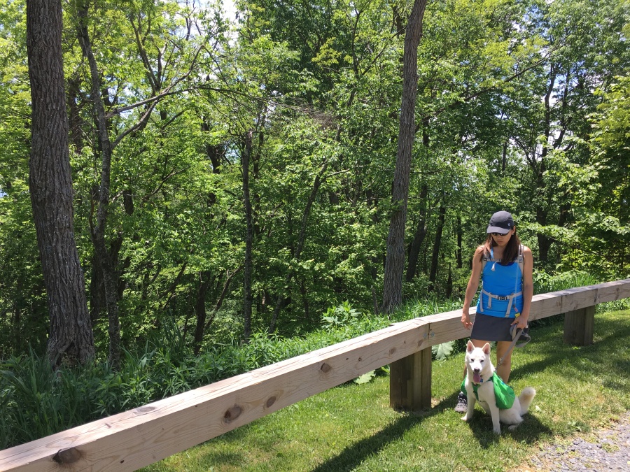
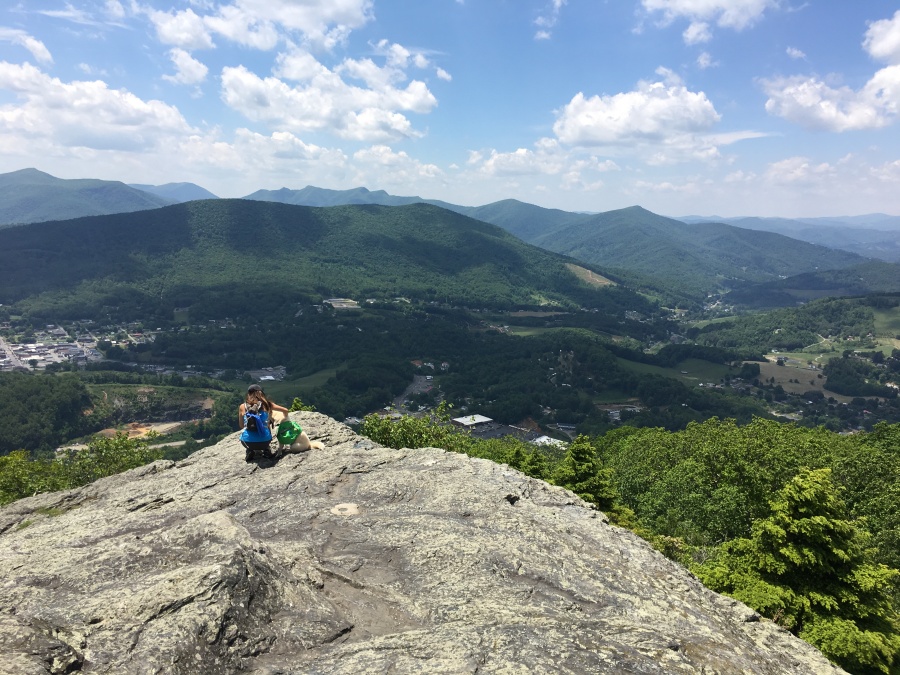
We crossed the parking lot and continued up the trail to a junction where the Rhododendron Trail diverges to the right. The best views may in fact be along this two mile loop trail, from Luther Rock; a very nice and helpful park employee back at the info center had spoken well of it. However we didn’t want to push Fitz too much on this balmy day…we’ll save that for another trip.
Here at the junction Fitz found a cozy den where he could lie out of the heat for a while. He’s been in the market for a solid, affordable den with a view for a while. This one however is not for sale.
At the junction we broke left to check out the summit. As is so oft the case in the Southern Appalachians, it is disappointing; there is only a very partial view from here. Brian, the tallest of the three amigos, was able to get this view only by lifting his “phamera” up over his head beyond the brush. There is also an interesting weather observatory and an ugly microwave tower. And a sign saying that it’s the summit. Finit.
A man passing told us that in the 1980’s, there used to be an old fire tower there, which was a derelict even then but could be climbed to enhance the views. The summit however was not a total disappointment, because there were dozens of butterflies swarming it.
Fitz also had his second, and best, meltdown of the day when Brian foolishly donated his water disk to a passing stranger with a thirsty dog. Don’t mess with the Zohan!
The trip back down, with Sylvia in control of Fitz, took no more than an hour. As on the way up, we noted the lower slopes of the trail were breezier than the upper, probably because of the prevailing winds. But either way, all of the wooded sections of this hike were surprisingly cool and pleasant despite a day that topped out at 94 degrees in Raleigh.
We both enjoyed Jefferson Mountain and will probably go back for the views from Luther Rock. The views from Jefferson Overlook along are worth stopping for, and like all NC State Parks, no admission fee is charged. Despite this being Memorial Day weekend, and the weather being clear and sunny, the park was not crowded, and we had the views almost to ourselves. We saw only a dozen people on the trail and only one other dog.
Jefferson Mountain is in our opinion greatly surpassed by nearby Elk Knob, which has less crowds, even greater views, a very well-built trail and no road to the summit. We’d compare Jefferson to Pilot Mountain, though less crowded. There are more views from Pilot, but the views from Jefferson of the surrounding Blue Ridge are better.
As stated, we like this area of the state…It’s less busy than the overcrowded Grandfather Mountain/Blowing Rock area further South. We like the town of Boone, which ranks with Brevard, Cashiers and Highlands as our favorite small mountain town in the Carolinas. There’s Elk Knob and Jefferson Mountain, the New River, and to the south is Stone Mountain. Just a few miles further north lies the Virginia border, across which is the Mount Rogers area, the Grayson Highlands, Damascus and the Virginia Creeper Trail. If you can’t find anything to do in this area you simply aren’t trying.
Another successful hike with Fitz Roy! We’ll be back for more adventures soon!