The Grayson Highlands, VA
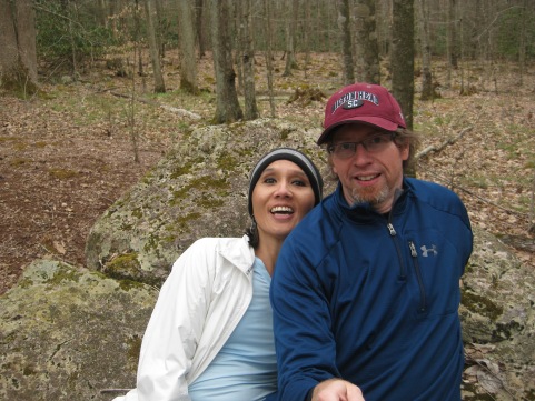
*We hiked the Grayson Highlands in April 2014 over a period of two consecutive days, first starting from the Mount Rogers Trailhead and later from Massie Gap in Grayson Highlands State Park. We covered a variety of trails on these hikes and saw virtually every part of the highlands, excepting the treed-in summit of Mt. Rogers itself. So if our ‘wardrobes’ appear to shift somewhat in the photos, be advised that it is not as a result of any malfunction.
**We have added the Grayson Highland to our list of Best Hikes in the Southern Appalachians. It currently holds BecauseItzThere’s title of “Best Southern Section of the AT.”
If you were to poll knowledgeable hikers on what the best section of trail in the Southeastern United States is, you would get many answers. But it’s good bet that this quartet would come to the fore…The Roan Mountains, The Smoky Mountains, The Grayson Highlands and the Art Loeb Trail. Three of those four are sections of the Appalachian Trail, no surprise.
Sylvia and I consider ourselves fairly knowledgeable hikers. If you polled us, we would rank them this way…
- Art Loeb Trail (Shining Rock Wilderness)
- Grayson Highlands
- Roan Mountains
- Smoky Mountains
…with the caveat that we have not done most of the interior sections of the Smoky Mountains, and that we did the Roans on a day when the views were almost entirely socked in. If we were to do all four of them again, and in full, right now, our ranking might well change.
BUT…we would also rank the Old Rag hike/rock hop ahead of all of them.
Today we’ll talk a bit about the Grayson Highlands. This is the remarkable series of alpine meadows on the flanks of of Mt. Rogers, which at 5,729 feet is Virginia’s highest point. Like a good many southern mountains, the summit of Rogers is entirely treed in, and the best views are actually not from the top. In this case, the best views are from the Grayson Highlands.
There are many trail options in the Grayson Highlands. Here Sylvia consults the map as Brian practices his befuddled face in advance of actually being ‘misplaced.’
In fact, the highlands link Virginia’s two highest summits…Whitetop Mountain, the second highest, is also accessible via the AT (though if you want to cheat, there is also a road to the top. Again, a too familiar story in the south.)
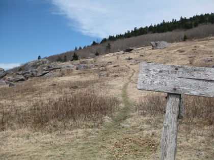
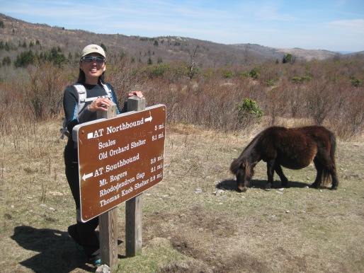
The easiest way to access the meadows is via Grayson Highlands State Park, which has a trailhead with a large parking area right at Massie Gap where the Highlands begin. From here it is just a half mile to the AT. Easy-peasy!
Too easy-peasy, in fact. ☹. Sylvia and I greatly prefer mountains you have to actually climb in order to experience rather than those that allow a motor to do all the work. Because of the easy access, the beautiful Highlands are pretty much open to everyone who owns a car and a GPS. And that means crowds.
But it’s still a wonderful place. And as always, I am surprised by how very much difference there is to be gained by simply walking away from the trail head. Most would-be hikers will not go more than three miles from a paved road, if that much.
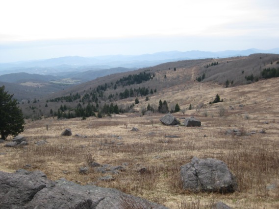
The highlands have great views, unobstructed for miles. Because they are so expansive, the tree-line is often far off and the views over meadows and scrub are quite scenic. We found these more impressive than other ‘balds’ we have visited, such as Gregory Bald.
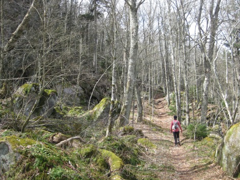
Sylvia and I climbed from the North side via the Mount Rogers Trail, which leaves out of Grindstone Campground, where we staged out of for the hike. This campground is notable to me as the place where, in 2008, just months after relocating from Texas to NC, I got a flat tire and was forced to do a bit of ‘auto-mechanicking’ on the spot. I still recall the fact that no less than three people stopped and offered to assist me.
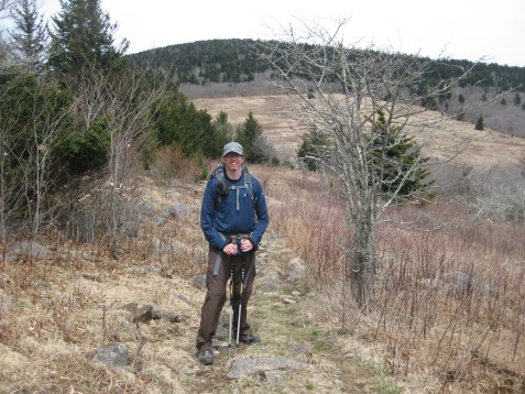
The Mount Rogers Trail is a fairly well graded trail that reaches the AT at Deep Gap, and then shortly after that, views appear on the right side of the trail. The trail keeps on going, back into the trees and then out again, passing the spur trail for the summit. But here, at the open area known as Brier Ridge, we decided to get off. We wanted to explore the highlands and not the closed in summit.
The Highlands are BIG. As in hundreds of acres. It’s not just a small area around the trail, they stretch on for miles. We walked cross country for at least a half mile out to a prominence on Brier Ridge. The open meadows kept going for at least another mile past this point – there was no end in sight.
We saw many signs of bootleg campsites. Note that while camping is not permitted inside the state park, camping IS permitted in the Mount Rogers Recreation Area. If you want to camp, check the regulations and be aware of where you are in relation to the park boundaries.
Also, there are hiker shelters and a developed campground in the state park. Check the regulations for fee requirements.
Be aware that if you do go cross country we recommend you wear long pants. The briers of aptly named Brier Ridge were quite sharp.
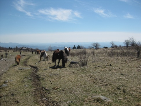
Another notable attraction of this place is the ‘Wild Ponies’ of the Highlands. There are over a hundred of these, famed for their docility, and in fact they have a reputation of licking the salt right from the clothes of sweaty hikers.
We saw at least a score of them. They were right on the trail, minding their business.
While they are often called wild, feral-but-managed might be a better term. The ponies were relocated to the park from elsewhere in the 1970’s intentionally to keep the growth on the meadows under control. Like many southern ‘balds’, the Highlands are a temporary phenomenon caused by fires and clear cutting, bound to return to their native woodland state in just a few generations if left alone. The ponies help keep them in their present open state for the enjoyment of all. The ponies are in turn managed by the park service as combination mobile tourist attraction/lawn mowing service.
Try to refrain from touching them. They may seem friendly but the ponies are not house pets. And it’s against the rules to approach too closely.
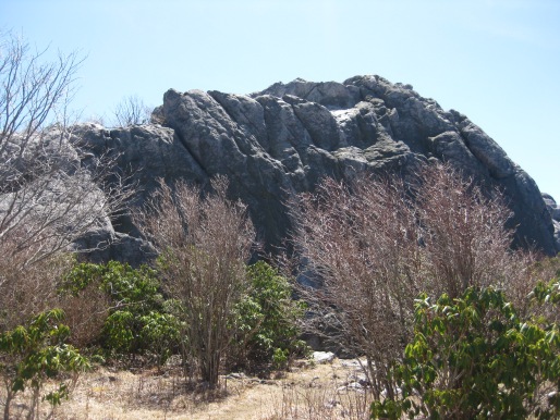
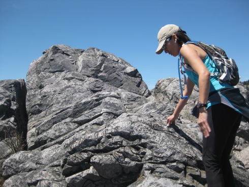
One of the things we really liked about the Highlands is the presence of several rock pinnacles and domes, some of which can be climbed. Too many of the southern balds are just flat, open, mundane places with the aspect of pastures. The presence of these rock formations adds to the wild character of the place and enhances the views, giving the hiker a viewing platform from which to take in the surroundings. Just be careful climbing them.
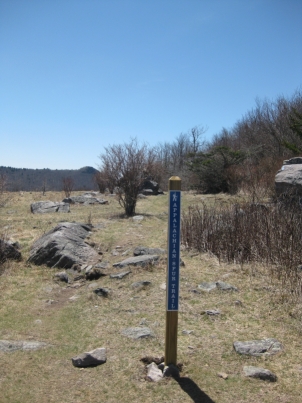
As stated, the AT runs right across the highlands. Though it was too early in the season for thru-hikers when we visited.
We consider the Highlands to be the best section of the AT we have done so far in the South, with the very strong caveat that we have NOT done the entire trail in the South. Particularly, we might change our mind if we ever catch the Roan Highlands on a day of good weather. This is an honor that is far from decided.
We strongly recommend a visit to the highlands to anyone who is interested in hiking. In fact, it is such a great place as to be worth the investment of at least a couple days. You could hike up the Mount Rogers Trail to the summit one day, then spend the second or even a third exploring Whitetop from the Elk Garden side or the areas around Massie Gap, where the ponies frequently are. Combine this with a visit to Damascus and a day on the Virginia Creeper Trail and there’s enough to do here for the better part of a week!
In fact, we did spend four whole days here and one of the things on our agenda was biking.
Next up: The Creep into Trail Town