Colca Canyon, Part Two: The Long Walk Down
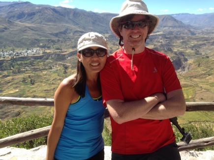
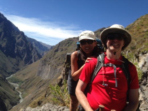
Arriving back at Chivay after the condor trip we prepared ourselves for three straight days of hiking in the canyon. The little pavilion at the start was mobbed with hikers; even though our tour consisted of just myself, Sylvia and the guide Eli, many tours start from here…serving as a reminder that Colca Canyon is Peru’s 3rd biggest tourist attraction, getting over 100,000 visitors annually. A lot of people, but then Grand Canyon sees fifty times that many. In evidence as well was the ubiquitous Peruvian retail kiosk with bottled water, soda, snacks and even hiking poles for sale. And a last-chance restroom with a manual-flush toilet (IE, a bucket of water.) You could use it for the price of one sol (about 35 cents.) Apart from this this, even bushes to hide behind are in short supply.
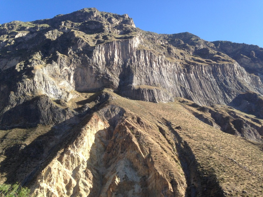
Soon we were underway. It was barely mid-morning, maybe about 9 am. Some of the best views are those had early…sweeping vistas up and down the canyon. Again, comparing this to the Grand Canyon, Colca is not only deeper but much more precipitous…unlike the Colorado River which is miles from the rim and usually hidden from view beneath ledges and plateaus, the Colca River is entirely visible to those who dare to look straight down. This means that the downhill is much steeper, but also relatively fast (it takes half a day of hiking to reach the Colorado from the rim, while a strong hiker can reach the Colca in perhaps three hours.)
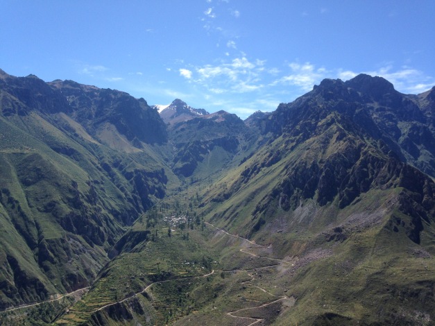
As we walked, the entire hike unfolded right in front of us. This is one of the odd things about canyon hiking…from the start you can see everyplace you will go, often surprisingly close at hand. But once you get deeper into the canyon, the landscape swallows everything. Only what the bending and twisting terrain will reveal is visible, which is often as not deceptive. We had a brief glimpse of the Oasis, our second days destination, as we turned a bend. We would not see it again for over 48 hours.
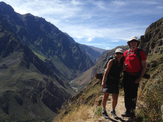
While steep, the downhill is not especially difficult. There was only one section that I would consider dangerously rough, and this was very short (less than ten meters.) There were a few sections that pass under rock ledges, and these tended to be the rougher ones, and the guide urged us not to stop for long in these areas. But we saw no rockfall. The biggest threat was the sun…there were almost no shaded areas on the south side of the canyon at all. No trees except for one clump at the very start, and what few shady spots there are created by folds in the canyon walls themselves (the micro-climates of these little oasis are shockingly cool.) But these are few and far between; mostly, this is a long way down along a trail that is continuously in bright sun. As you get closer to the bottom, it gets hotter. And there is no water at all between rim and river except what you bring. By the time you gratefully reach the Rio Colca, it is obvious why an early start is considered mandatory on the ascent.

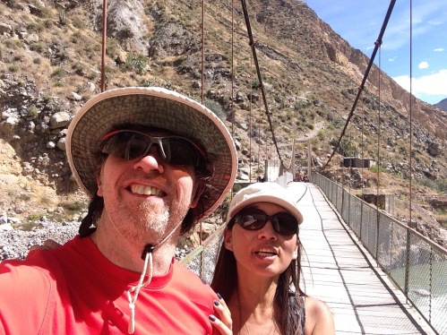
The river is crossed by means a large and impressive looking suspension foot bridge…which like all suspension bridges shakes alarmingly when crossed, but seems safe enough. After resting in the shelter of a boulder we turned sharply uphill to scale the river embankment, the first climb of the trip. Fortunately, elevation is not as much a factor at river level as on the rim. Eli the guide detoured us through a rough, jungle-like section to reach the final stop of the day; Roy’s Lodge in the village of San Juan de Chuccho.

The contrast between the barren south side of the canyon and the cultivated north side could hardly be greater. While not a tree stands on the sun-baked south wall, the north is not only lush but populated. Agricultural terraces shaded by orchard trees line the hillside, supported by systems of well maintained aqueducts. Villages dot the hillside in abundance. Crossing the river one leaves a starkly beautiful desert hellscape and enters a place that can truthfully be called a paradise, each separated by a moat of water perhaps twenty yards wide.
We sat down for a fine lunch at Roy’s, where we had a view of the canyon wall before us, and the lower part of the trail switch-backing down it. We were done for the day but some tourists were still making the laborious descent, in full view of us and in the full heat of mid-day.
After lunch and a tour of our accommodations (private cabins which included bathrooms, but no hot water and no electric lights) we went out for a walk with the guide. The abundance of foodstuffs growing here is incredible…pumpkins, figs, dates, avocados, various kinds of fruits and of course the staple of the Andean peoples, corn. Sadly, we also learned from Eli that the villages we saw are mostly metal-roofed derelicts. Despite its lushness, agriculture beyond the subsistence level is impossible in the canyon. You can grow food, but you can’t easily get it out of the canyon to market. With few opportunities for work or schooling, the young people of the villages are leaving for the cities. Those that stay are mostly the old, and those (like Roy’s family) that support the tourist infrastructure. In a few years, the culture will be entirely gone. Only the hotels and empty buildings will remain.
See out video on YouTube here!
Next up: The Deep Abode of the Rio Colca