Sharp Top via Sharp Top Trail
*One of our Top Ten Hikes in the Southern Appalachians!
- Location: Peaks of Otter, Blue Ridge Pkwy, VA
- Distance: 2.6 miles Round Trip from the Sharp Top Store
- Elevation Gain: 1227 Feet
- Time: From two to four hours
- Difficulty: Moderately Strenuous
- Best season: Early Spring or Late Fall
- B.I.T. Rating ***1/2
Directions: Located at Peaks of Otter Recreation Area, Milepost 85.6 North of Roanoke, VA on the Blue Ridge Parkway. Or take VA Route 43 out of Bedford, VA, to the intersection with the BRP. The actual trail head is at the Nature Center on the northbound side of the Parkway; however most hikers park at the Sharp Top Store and cut out about a third of a mile of mostly pointless walking.
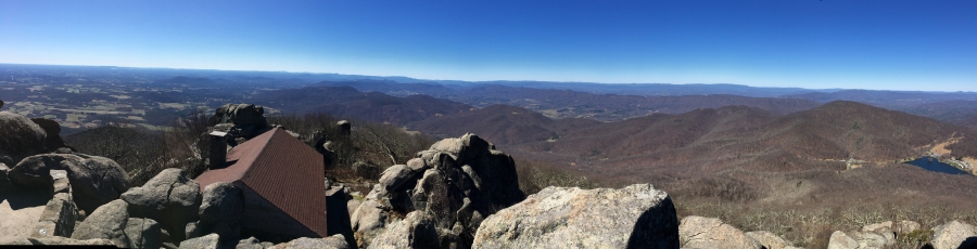
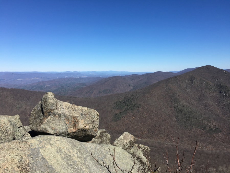
Brief Description: On a good day this might be the best single viewpoint in Virginia; a rocky aerie perched high above the blue ridge with views as far south as North Carolina and as far north as Maryland. But this is also a very situational hike; avoid the summer season when crowds of tourists, haze, humidity and threat of thunderstorms will detract from the experience.
Trail Map (from AllTrails)

Why Do This Hike?
- Might be the best single viewpoint in Virginia
- 360 degree view from a rocky top summit
- Sharp Top dominates the landscape around it
- Some views from the ridges on the way up as well
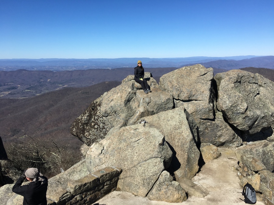
- Interesting rock formations on the summit ridge
- optional side trip to the Buzzards Roost view point
- Much longer side trip to neighboring Flat Top
- Pretty short (though steep) climb to the summit
- Optional bushwhack to B-25 bomber wreckage site located on the mountain (please be respectful of the site, the crew was killed)
- Cap the hike off with a scenic drive along the Blue Ridge Parkway
But First, Consider:
- Not recommended in summer
- There is a seasonal shuttle bus that deposits tourists a quarter mile from the summit, IE after the heavy climbing is over
- Expect large crowds of non hikers
- A popular hike close to many college towns
- Even in the off season, not likely you will have this summit to yourself
- There is an abandoned cabin and some old stonework viewing platforms and steps at the summit
- Haze and smog can really impact the views in this part of the Blue Ridge
- Views are not exactly of wilderness, much of it is rustic farmland and villages
- Very steep in sections; lots of stone steps
- Not recommended in icy conditions (viewing platform makes it safe in all other conditions, though)
- Lightning strike danger when thunderstorms threaten
- Do this mid week, in late fall or early spring, preferably on a cool, crisp, clear day
- Some hikers might prefer the challenge of a longer, less used trail (like that to Flat Top)
- Save this one for the day when there’s a really fine view
Did You Know? The Peaks of Otter (Sharp and Flat Top) were once thought to be the tallest peaks in North America. This turned out to be off by only half the height of Mount Everest; they aren’t even the tallest in the Blue Ridge.
![IMG_0004[1545]](https://becauseitzthere.files.wordpress.com/2018/03/img_00041545-e1570586388629.jpg?resize=480%2C358)