Art Loeb Trail, Pisgah NF
*One of our Top Ten Hikes in the Southern Appalachians!
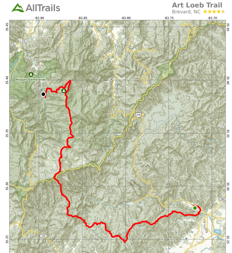
- Location: Pisgah National Forest, NC
- Distance: 28.5 miles for full trail; about 4 miles for Black Balsam section
- Elevation Gain: 8,257 ft cumulative for full trail; much less for just Black Balsams
- Time: Three or four days for full trail; a few hours for the Black Balsams
- Difficulty: Full Trail is Strenuous; Black Balsams, Moderate
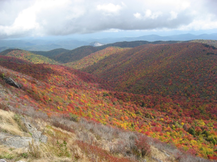
- Best season: Fall
- B.I.T. Rating ****
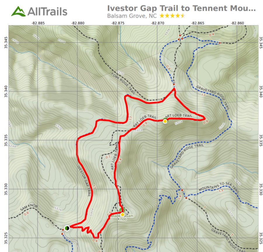
Directions: Two possible itineraries here. The full trail option leaves from Davidson River Campground outside Brevard NC and ends, many miles and days later, at the Daniel Boone Boy Scout Camp in Canton NC. See links for directions to both. Note that these two locations are quite far apart even by car; a shuttle is required. The shorter itinerary leaves from Black Balsam Road off the Blue Ridge Parkway (MP 420) at a well marked parking area and returns via a loop or the same trail.
Brief Description: This is possibly the best trail in the entire Southeastern United States. The Art Loeb Trail is a rugged, multi-day wilderness backpacking adventure that takes you through some of the deepest wild areas in North Carolina, with great views en route and a chance to summit 6030 foot Cold Mountain. However, the most scenic section of this trail — over Black Balsam and Tennent Mountains — is easily done as a four mile out and back or loop from the Blue Ridge Parkway.
Why Hike This?
- All things considered this could be the best trail in the Southern Appalachians
- Excepting a few sections this is a real wilderness hike
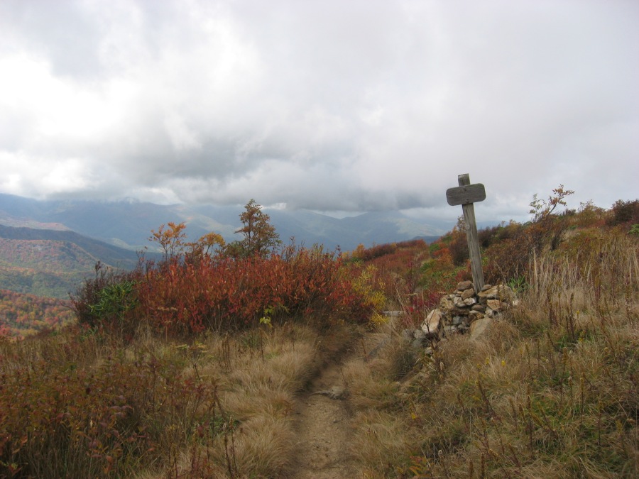
- Great views from many spots
- Continuous open section near Black Balsam/Tennent Mountain
- Optional side trip to 6030 foot Cold Mountain
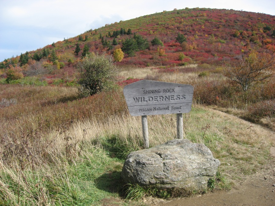
- The pristine Shining Rock Wilderness
- Fine views of Looking Glass Rock
- Huge panoramic views with almost no sign of human habitation
- You will have much of this trail to yourself
- Real chance of seeing wildlife
- This is a GREAT fall color hike
- You can extend hike to take in nearby Graveyard Fields
But First Consider:
- The full trail is a serious hike through remote wilderness
- Recommended to experienced, self sufficient backpackers
- Full backpack required
- Shuttle or two cars needed
- A TON of climbing and not many views for first day or maybe two of the full trail
- Steep ascent to Shut-In Ridge right off the bat
- Very Steep and long slog up Pilot Mountain
- Descent from Cold Mountain has more rough and steep sections
- Those who can’t handle all the above are advised to stick to the short option
- Trail not marked in the wilderness sections and can be very hard to follow in places
- Many side trails, herd paths, fire roads…map strongly recommended
- Fog may obscure trail in the exposed sections
- Beware of bad weather in the open areas; high winds, freezing rain, lightning
- The Shining Rock Wilderness is quite remote, no easy evac from many areas
- The Shining Rocks themselves are a disappointment to many
- Many fine views but most of this trail is in the trees
- The trail has very remote sections, but the areas around the BRP (which have the best views) are easily accessed and sometimes crowded
- In summer expect bugs and heat; in winter, deep snow and freezing temps
Note that the USFS website has good resources for this hike but they are very poorly organized, being distributed over several web pages with no common landing page…we recommend you use this link to The Hiking Project’s page for the ALT which has links to all the relevant sites.